Tanagura, Fukushima
| Tanagura 棚倉町 | |||
|---|---|---|---|
| Town | |||
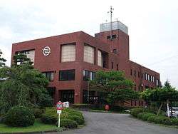 Tanagura Town Hall | |||
| |||
|
Location of Tanagura in Fukushima Prefecture | |||
 Tanagura | |||
| Coordinates: 37°01′47.5″N 140°22′46.5″E / 37.029861°N 140.379583°ECoordinates: 37°01′47.5″N 140°22′46.5″E / 37.029861°N 140.379583°E | |||
| Country | Japan | ||
| Region | Tōhoku | ||
| Prefecture | Fukushima | ||
| District | Higashishirakawa | ||
| Area | |||
| • Total | 159.93 km2 (61.75 sq mi) | ||
| Population (May 2018) | |||
| • Total | 14,229 | ||
| • Density | 89/km2 (230/sq mi) | ||
| Time zone | UTC+9 (Japan Standard Time) | ||
| - Tree | Japanese Red Pine | ||
| - Flower | Azalea | ||
| Phone number | 0247-33-3111 | ||
| Address | 33 Nakayano, Tanagura, Tanagura-machi, Higashishirakawa-gun, Fukushima-ken 963-6131 | ||
| Website | Official website | ||
Tanagura (棚倉町 Tanagura-machi) is a town located in Fukushima Prefecture, Japan. As of 1 May 2018, the town had an estimated population of 14,229 in 5029 households [1], and a population density of 89 persons per km². The total area of the town was 159.93 square kilometres (61.7 sq mi).
Geography
Tanagura is located in the southernmost portion of Fukushima prefecture, bordering on Tochigi Prefecture to the west and Ibaraki Prefecture to the south. Tanagura has a humid climate (Köppen climate classification Cfa). The average annual temperature in Tanagura is 11.6 °C (52.9 °F). The average annual rainfall is 1,408 mm (55.4 in) with September as the wettest month.[2]
- Mountains: Yamizosan (1021.8m)
- Rivers: Kuji River
Neighboring municipalities
Demographics
Per Japanese census data,[3] , the population of Tanagura has remained fairly constant over the past 40 years.
| Census Year | Population |
|---|---|
| 1970 | 16,621 |
| 1980 | 16,105 |
| 1990 | 16,606 |
| 2000 | 16,376 |
| 2010 | 15,062 |
History
The area of present-day Tanagura was part of ancient Mutsu Province. The area formed part of the holdings of Tanagura Domain, in the Edo period. After the Meiji Restoration, it was organized as part Higashishirakawa District within the Nakadōri region of Iwaki Province. Tanagura Town was formed on April 1, 1889 with the creation of the modern municipalities system. The town expanded on January 1, 1950 by the annexation of the neighboring villages of Yashirogawa, Chikaatsu, Yamaoka and Takano.
Economy
Tanagura has mixed economy with agriculture and precision manufacturing predominating.
Education
Tanagura has five public elementary schools and one public junior high school operated by the town government, and one public high school operated by the Fukushima Prefectural Board of Education.
High schools
- Tanagura High School
Junior High school
- Tanagura Junior High School
elementary school
- Tanagura Elementary School
- Yashirogawa Elementary School
- Chikatsu Elementary School
- Takabo Elementary School
- Yamaoka Elementary School
Transportation
Railway
Highway
International relations


Local attractions
- Site of Tanagura Castle
External links
![]()
- Official website(in Japanese)