Tai'an
| Tai'an 泰安市 | |
|---|---|
| Prefecture-level city | |
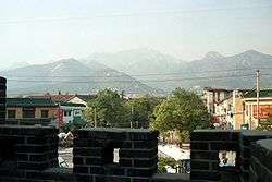 Mount Tai seen across Tai'an | |
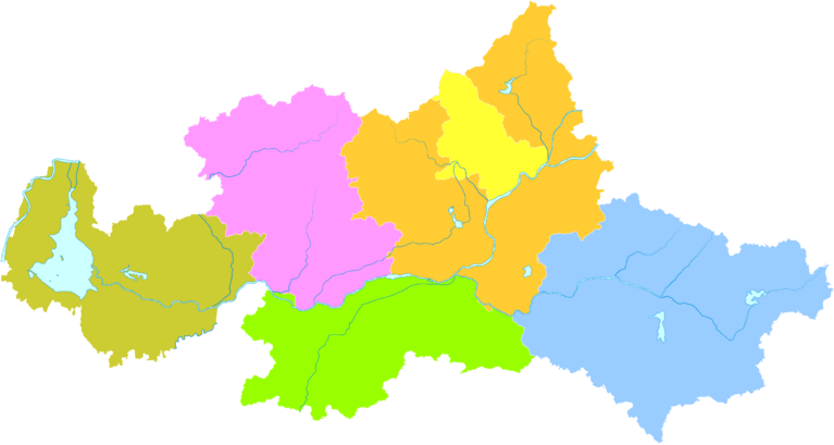
 Location of Tai'an City jurisdiction in Shandong | |
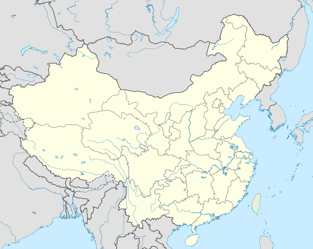 Tai'an Location in China | |
| Coordinates: 36°12′N 117°05′E / 36.200°N 117.083°ECoordinates: 36°12′N 117°05′E / 36.200°N 117.083°E | |
| Country | People's Republic of China |
| Province | Shandong |
| County-level divisions | 6 |
| Municipal seat |
Taishan District (36°10′N 117°07′E / 36.167°N 117.117°E) |
| Government | |
| • CPC Secretary | Wang Yunpeng |
| • Mayor | Li Xixin |
| Area | |
| • Prefecture-level city | 7,761.83 km2 (2,996.86 sq mi) |
| • Urban | 2,086.8 km2 (805.7 sq mi) |
| • Metro | 2,086.8 km2 (805.7 sq mi) |
| Elevation | 167 m (548 ft) |
| Highest elevation (Mount Tai) | 1,645 m (5,397 ft) |
| Population (2010 census) | |
| • Prefecture-level city | 5,494,207 |
| • Density | 710/km2 (1,800/sq mi) |
| • Urban | 1,735,425 |
| • Urban density | 830/km2 (2,200/sq mi) |
| • Metro | 1,735,425 |
| • Metro density | 830/km2 (2,200/sq mi) |
| Time zone | UTC+8 (China Standard) |
| Area code(s) | 538 |
| ISO 3166 code | CN-SD-09 |
| License Plate Prefix | 鲁J |
| Website |
www |
Tai'an (Chinese: 泰安; pinyin: Tài'ān) is a prefecture-level city in western Shandong province of the People's Republic of China. Centered on Mount Tai, the city borders the provincial capital of Jinan to the north, Laiwu to the northeast, Zibo to the east, Linyi to the southeast, Liaocheng to the extreme west and Jining to the south. To the west, Tai'an is separated from the province of Henan by the Yellow River.
Its population was 5,494,207 as of the 2010 census, of whom 1,735,425 lived in the built-up (or metro) area made of 2 urban districts (Taishan District and Daiyue District).
Administration
The prefecture-level city of Tai'an administers 6 county-level divisions, including 2 districts, 2 county-level cities and 2 counties.
- Taishan District (泰山区)
- Daiyue District (岱岳区)
- Xintai City (新泰市)
- Feicheng City (肥城市)
- Ningyang County (宁阳县)
- Dongping County (东平县)
| Map |
|---|
History
Tai'an was home to the Dawenkou culture during the neolithic era. During the Spring and Autumn period and the Warring States period, the region belonged to the states of Qi and Lu. The site of major historical and cultural significance in the area is Mount Tai.
Geography and climate
Tai'an is centered on the south side of Mount Tai.Dongping Lake is the biggest lake.
Tai'an lies in the northern temperate zone and has a continental, semi-humid monsoon climate. The average annual temperatures are −2.1 °C (28.2 °F) (January), 12.8 °C (55.0 °F) (annual average), and 26.0 °C (78.8 °F) (July). The average annual precipitation is 681 mm (26.8 in).
| Climate data for Tai'an (normals 1971–2000, extremes 1951–2000) | |||||||||||||
|---|---|---|---|---|---|---|---|---|---|---|---|---|---|
| Month | Jan | Feb | Mar | Apr | May | Jun | Jul | Aug | Sep | Oct | Nov | Dec | Year |
| Record high °C (°F) | 15.8 (60.4) |
21.8 (71.2) |
26.1 (79) |
33.8 (92.8) |
38.6 (101.5) |
40.7 (105.3) |
39.6 (103.3) |
40.0 (104) |
34.6 (94.3) |
31.6 (88.9) |
27.1 (80.8) |
17.4 (63.3) |
40.7 (105.3) |
| Daily mean °C (°F) | −2.1 (28.2) |
0.1 (32.2) |
6.3 (43.3) |
13.7 (56.7) |
19.1 (66.4) |
24.4 (75.9) |
26.0 (78.8) |
25.1 (77.2) |
20.2 (68.4) |
14.2 (57.6) |
6.4 (43.5) |
−0.2 (31.6) |
12.8 (55) |
| Record low °C (°F) | −22.4 (−8.3) |
−19.3 (−2.7) |
−12.6 (9.3) |
−5.7 (21.7) |
0.7 (33.3) |
8.2 (46.8) |
13.1 (55.6) |
10.4 (50.7) |
1.8 (35.2) |
−3.3 (26.1) |
−12.6 (9.3) |
−20.3 (−4.5) |
−22.4 (−8.3) |
| Average precipitation mm (inches) | 6.4 (0.252) |
7.4 (0.291) |
18.3 (0.72) |
27.0 (1.063) |
43.6 (1.717) |
90.6 (3.567) |
209.9 (8.264) |
151.4 (5.961) |
65.6 (2.583) |
39.6 (1.559) |
11.7 (0.461) |
9.7 (0.382) |
681.2 (26.82) |
| Average precipitation days (≥ 0.1 mm) | 2.4 | 3.2 | 4.7 | 5.4 | 6.5 | 8.6 | 13.6 | 10.5 | 7.1 | 5.0 | 3.5 | 3.1 | 73.6 |
| Source #1: Weather China[1] | |||||||||||||
| Source #2: [2] | |||||||||||||
Education
- Shandong University of Science and Technology
- Tai mountain shaolin kung fu school China
- Taishan Medical University
- Shandong Agricultural University
- Mount Tai College
- Tai'an Public Health School
- Tai'an Polytechnic College
- Taishan medical university
- Shandong Foreign Trade Vocational College Taian Campus
Transportation
Tai'an (Taishan Station) is located on the Jing-Hu Railway Line, which connects Beijing to Shanghai, as well as on the Jing-Hu Expressway and on the Tai-Lai Expressway (west-east from Tai'an to Laiwu). There is a four-lane highway from Tai'an to the Jinan Airport. Within Tai'an there are large tree lined avenues throughout the city. The nearest major airport is Jinan Yaoqiang International Airport, about 120 km (75 mi) to the north.
See also
References
- ↑ 泰安 - 气象数据 -中国天气网 (in Chinese). Weather China.
- ↑ 中国气象局 国家气象信息中心 (in Chinese). China Meteorological Administration. Archived from the original on 18 March 2013. Retrieved 12 December 2012.
External links

- Government website of Tai'an (in Simplified Chinese)
| Sub-provincial cities |
| ||||||||||||||||||||||||||||||
|---|---|---|---|---|---|---|---|---|---|---|---|---|---|---|---|---|---|---|---|---|---|---|---|---|---|---|---|---|---|---|---|
| Prefecture-level cities |
| ||||||||||||||||||||||||||||||
| |||||||||||||||||||||||||||||||
Major cities along the Yellow River | ||
|---|---|---|
| Province-level subdivisions | Cities (from upper reaches to lower reaches) |  |
| Gansu | ||
| Ningxia | ||
| Inner Mongolia | ||
| Shanxi | ||
| Shaanxi | ||
| Henan | ||
| Shandong | ||
Major cities along the Pearl River · Major cities along the Yangtze River | ||