Tagajō
| Tagajō 多賀城市 | |||
|---|---|---|---|
| City | |||
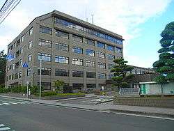 Tagajō City Hall | |||
| |||
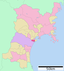 Location of Tagajō in Miyagi Prefecture | |||
 Tagajō | |||
| Coordinates: 38°17′37.8″N 141°0′15.3″E / 38.293833°N 141.004250°ECoordinates: 38°17′37.8″N 141°0′15.3″E / 38.293833°N 141.004250°E | |||
| Country | Japan | ||
| Region | Tōhoku | ||
| Prefecture | Miyagi | ||
| Government | |||
| • Mayor | Kikuchi Kenjirou | ||
| Area | |||
| • Total | 19.69 km2 (7.60 sq mi) | ||
| Population (August 2017) | |||
| • Total | 62,172 | ||
| • Density | 3,160/km2 (8,200/sq mi) | ||
| Time zone | UTC+9 (Japan Standard Time) | ||
| - Tree | Camellia sasanqua | ||
| - Flower | Iris sanguinea | ||
| Phone number | 022-368-1141 | ||
| Address | 1-1 Chūō 2-chōme, Tagajō-shi, Miyagi-ken 985-8531 | ||
| Website | http://www.city.tagajo.miyagi.jp/ | ||


Tagajō (多賀城市 Tagajō-shi) is a city located in Miyagi Prefecture, Japan. As of 1 August 2017, the city had an estimated population of 62,172, and a population density of 3160 persons per km2. The total area of the city is 19.64 square kilometres (7.58 sq mi). The city was named after Taga Castle, the capital of Mutsu Province from the Nara period.
Geography
Tagajō is in east-central Miyagi Prefecture, bordered by the Pacific Ocean to the east.
Neighboring municipalities
- Miyagi Prefecture
Demographics
Per Japanese census data,[1] the population of Tagajō has increased over the past 40 years.
| Census Year | Population |
|---|---|
| 1970 | 36,677 |
| 1980 | 50,785 |
| 1990 | 60,625 |
| 2000 | 61,457 |
| 2010 | 63,060 |
Climate
Tagajō has a humid climate (Köppen climate classification Cfa) characterized by mild summers and cold winters. The average annual temperature in Tagajō is 12.3 °C. The average annual rainfall is 1225 mm with September as the wettest month.The temperatures are highest on average in August, at around 24.8 °C, and lowest in January, at around 1.1 °C.[2]
History
The area of present-day Tagajō was part of ancient Mutsu Province, and has been settled since at least the Jōmon period by the Emishi people. In 729 AD, during the Nara period, a large fortified settlement, Taga Castle, was established by the Yamato dynasty as a military center to establish control over the region and to protect colonists from western Japan. The fortification became the administrative capital of Mutsu province. The tsunami in 869 caused extensive flooding of the Sendai plain, destroying the town of Tagajō. Archaeological investigations have identified the remains of 8th and 9th century buildings beneath the present town, covered by sediments dated to the middle of the 10th century.[3]
During the later portion of the Heian period, the area was ruled by the Northern Fujiwara. During the Sengoku period, the area was contested by various samurai clans before the area came under the control of the Date clan of Sendai Domain during the Edo period, under the Tokugawa shogunate. After the start of the Meiji period, the modern village of Tagajō was established with the creation of the municipalities system on April 1, 1889. From 1945 to 1954, a United States Army base, Camp Loper, was located in the town. Tagajō was elevated to town status on July 1, 1951. In the mid-1960s, the town was designated as an industrial development zone due to its proximity to Sendai harbor. Tagajō was designated a city on November 1, 1971. The city was seriously affected by the tsunami caused by the 2011 Tōhoku earthquake.[4] As of April 7, 2011, 177 people were known dead, with 15 missing. 1,811 people were living in shelters.[5]
Government
Tagajō has a mayor-council form of government with a directly elected mayor and a unicameral city legislature of 18 members.
Economy
Education
- Tohoku Gakuin University – Tagajō campus
- Tagajō has six public elementary schools and five public junior high schools operated by the city government and two public high schools operated by the Miyagi Prefectural Board of Education. There is also one private high school.
Transportation
Railway
- East Japan Railway Company (JR East) – Tōhoku Main Line
- East Japan Railway Company (JR East) – Senseki Line
Highway
Local attractions
- site of Site of Tagajō
- Tōhoku History Museum
International relations
Twin towns — Sister cities
Tagajō is twinned with:

Noted people from Tagajō
- Taiji Ishimori – professtional wrestler [7]
- Yudai Chiba – actor
References
- ↑ Tagajō population statistics
- ↑ Tagajō climate data
- ↑ Minoura, K.; Imamura F.; Sugawara D.; Kono Y.; Iwashita T. (2001). "The 869 Jōgan tsunami deposit and recurrence interval of large-scale tsunami on the Pacific coast of northeast Japan" (PDF). Journal of Natural Disaster Science. 23 (2): 83–88. Archived from the original (PDF) on 1 April 2011. Retrieved 12 March 2011.
- ↑ http://www.thedailynewsegypt.com/world/japan-quake-tsunami-death-toll-likely-over-10000-dp1.html Japan quake-tsunami death toll likely over 10,000
- ↑ Aoki, Mizuho, "U.S. teacher stays to return favor to helpful residents of Miyagi town", Japan Times, 7 April 2011, p. 3.
- ↑ "Access & Map." Sony. Retrieved on January 19, 2009.
- ↑ "石森 太二 (Ishimori Taiji)" (in Japanese). Pro Wrestling Noah. Retrieved 4 February 2012.
External links
![]()
- Official Website (in Japanese)