Tabuelan
| Tabuelan | ||
|---|---|---|
| Municipality | ||
| Municipality of Tabuelan | ||
 Tabuela beach | ||
| ||
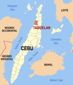 Map of Cebu with Tabuelan highlighted | ||
.svg.png) Tabuelan Location within the Philippines | ||
| Coordinates: 10°51′N 123°54′E / 10.85°N 123.9°ECoordinates: 10°51′N 123°54′E / 10.85°N 123.9°E | ||
| Country |
| |
| Region | Central Visayas (Region VII) | |
| Province | Cebu | |
| District | 4th district of Cebu | |
| Founded | 1953 | |
| Barangays | 12 (see Barangays) | |
| Government [1] | ||
| • Type | Sangguniang Bayan | |
| • Mayor | Rex Gerona | |
| • Vice Mayor | Raul Gerona | |
| • Congressman | Benhur Salimbangon | |
| • Electorate | 17,880 voters (2016) | |
| Area [2] | ||
| • Total | 141.13 km2 (54.49 sq mi) | |
| Elevation | 10 m (30 ft) | |
| Population (2015 census)[3] | ||
| • Total | 25,630 | |
| • Density | 180/km2 (470/sq mi) | |
| Time zone | UTC+8 (PST) | |
| ZIP code | 6044 | |
| PSGC | 072249000 | |
| IDD : area code | +63 (0)32 | |
| Climate type | Tropical climate | |
| Income class | 4th municipal income class | |
| Revenue (₱) | 85,901,394.94 (2016) | |
| Native languages |
Cebuano Tagalog | |
Tabuelan, officially the Municipality of Tabuelan, (Cebuano: Lungsod sa Tabuelan; Tagalog: Bayan ng Tabuelan), is a 4th class municipality in the province of Cebu, Philippines. According to the 2015 census, it has a population of 25,630 people.[3]
Tabuelan is bordered to the north by the town of San Remigio, to the west is the Tañon Strait, to the east are the towns of Borbon and Sogod, and to the south is the town of Tuburan.
History
The Municipality of Tabuelan used to be a barangay of Tuburan until the 1950s. And also was Tuburan's largest Barangay at the time. In fact, all of its constituent barangays were once barrio of then Barangay Tabuelan. In 1953, Tabuelan was separated via a Philippine Law from its mother municipality of Tuburan, on the grounds that Barangay Tabuelan is far from the administrative center of Tuburan (Poblacion Tuburan) and hence, it was not able to properly maintain and address the needs of the people in that barangay. Tuburan opposed such partition but when the law was upheld, it humbly gave way and followed the mandate of the law to avoid economic repercussions. Hence, being formally established as a full-fledged Municipality in 1953, makes Tabuelan, the newest and youngest municipality in Cebu Island.
Barangays
Tabuelan comprises 12 barangays:
| PSGC | Barangay | Population | ±% p.a. | |||
|---|---|---|---|---|---|---|
| 2015[3] | 2010[4] | |||||
| 072249001 | Bongon | 14.4% | 3,701 | 3,315 | 2.12% | |
| 072249010 | Dalid | 5.1% | 1,318 | 1,262 | 0.83% | |
| 072249005 | Kanlim‑ao | 3.8% | 972 | 980 | −0.16% | |
| 072249006 | Kanluhagon | 4.0% | 1,026 | 1,018 | 0.15% | |
| 072249008 | Kantubaon | 6.7% | 1,709 | 1,672 | 0.42% | |
| 072249013 | Mabunao | 3.7% | 947 | 747 | 4.62% | |
| 072249014 | Maravilla | 10.0% | 2,573 | 2,171 | 3.29% | |
| 072249015 | Olivo | 8.3% | 2,120 | 1,897 | 2.14% | |
| 072249016 | Poblacion | 20.3% | 5,201 | 4,796 | 1.56% | |
| 072249017 | Tabunok | 13.8% | 3,531 | 2,266 | 8.81% | |
| 072249018 | Tigbawan | 8.1% | 2,073 | 1,767 | 3.09% | |
| 072249019 | Villahermosa | 1.8% | 459 | 401 | 2.61% | |
| Total | 25,630 | 22,292 | 2.69% | |||
Transportation
V-Hire, Ceres Liner and Mini Buses are among the PUVs going to the town. They mostly bypass here for their Main Routes are either San Remigio or Tuburan.
Demographics
| Population census of Tabuelan | ||
|---|---|---|
| Year | Pop. | ±% p.a. |
| 1960 | 19,626 | — |
| 1970 | 12,961 | −4.06% |
| 1975 | 13,890 | +1.40% |
| 1980 | 14,499 | +0.86% |
| 1990 | 15,515 | +0.68% |
| 1995 | 16,936 | +1.66% |
| 2000 | 19,373 | +2.92% |
| 2007 | 21,421 | +1.40% |
| 2010 | 22,292 | +1.46% |
| 2015 | 25,630 | +2.69% |
| Source: Philippine Statistics Authority[3][4][5][6] | ||
References
- ↑ "Municipality". Quezon City, Philippines: Department of the Interior and Local Government. Retrieved 31 May 2013.
- ↑ "Province: Cebu". PSGC Interactive. Quezon City, Philippines: Philippine Statistics Authority. Retrieved 12 November 2016.
- 1 2 3 4 Census of Population (2015). "Region VII (Central Visayas)". Total Population by Province, City, Municipality and Barangay. PSA. Retrieved 20 June 2016.
- 1 2 Census of Population and Housing (2010). "Region VII (Central Visayas)". Total Population by Province, City, Municipality and Barangay. NSO. Retrieved 29 June 2016.
- ↑ Censuses of Population (1903–2007). "Region VII (Central Visayas)". Table 1. Population Enumerated in Various Censuses by Province/Highly Urbanized City: 1903 to 2007. NSO.
- ↑ "Province of Cebu". Municipality Population Data. Local Water Utilities Administration Research Division. Retrieved 17 December 2016.
| Wikimedia Commons has media related to Tabuelan. |
External links
Places adjacent to Tabuelan | ||||||||||
|---|---|---|---|---|---|---|---|---|---|---|
| ||||||||||
Cebu City (capital) | |
| Municipalities |
|
| Component cities | |
| Highly urbanized cities | (Administratively independent from the province but grouped under Cebu by the Philippine Statistics Authority. However, qualified voters in Mandaue are allowed to vote in elections for Cebu provincial officials as part of the 6th Sangguniang Panlalawigan district.) |