Alcantara, Cebu
| Alcantara | |
|---|---|
| Municipality | |
| Municipality of Alcantara | |
 Alcantara, Cebu – National road | |
 Map of Cebu with Alcantara highlighted | |
.svg.png) Alcantara Location within the Philippines | |
| Coordinates: 9°58′N 123°26′E / 9.97°N 123.43°ECoordinates: 9°58′N 123°26′E / 9.97°N 123.43°E | |
| Country |
|
| Region | Central Visayas (Region VII) |
| Province | Cebu |
| District | 7th District of Cebu |
| Founded | 1830 |
| Barangays | 9 (see Barangays) |
| Government [1] | |
| • Type | Sangguniang Bayan |
| • Mayor | Syrel Marcellana |
| • Vice Mayor | Fritz Lastimoso |
| • Congressman | Peter John Calderon |
| • Electorate | 10,102 voters (2016) |
| Area [2] | |
| • Total | 35.20 km2 (13.59 sq mi) |
| Elevation | 149 m (489 ft) |
| Population (2015 census)[3] | |
| • Total | 15,160 |
| • Density | 430/km2 (1,100/sq mi) |
| Time zone | UTC+8 (PST) |
| ZIP code | 6033 |
| PSGC | 072201000 |
| IDD : area code | +63 (0)32 |
| Climate type | Tropical climate |
| Income class | 5th municipal income class |
| Revenue (₱) | 49,407,240.28 (2016) |
| Native languages |
Cebuano Tagalog |
Alcantara, officially the Municipality of Alcantara, (Cebuano: Lungsod sa Alcantara; Tagalog: Bayan ng Alcantara), is a 5th class municipality in the province of Cebu, Philippines. According to the 2015 census, it has a population of 15,160 people.[3]
Alcantara is bordered to the north by the town of Ronda, to the west is the Tañon Strait, to the east is the town of Argao, and to the south is the town of Moalboal.
Barangays
Alcantara comprises 9 barangays:
|
||||||||||||||||||||||||||||||||||||||||||||||||||||||||||||||||||||||||||||||||||||

Demographics
| Population of Alcantara | |||||||||||||||||||||||||||||||||||||||||||||||||
|---|---|---|---|---|---|---|---|---|---|---|---|---|---|---|---|---|---|---|---|---|---|---|---|---|---|---|---|---|---|---|---|---|---|---|---|---|---|---|---|---|---|---|---|---|---|---|---|---|---|
|
| ||||||||||||||||||||||||||||||||||||||||||||||||
| Source: Philippine Statistics Authority[3] [4] [5] | |||||||||||||||||||||||||||||||||||||||||||||||||
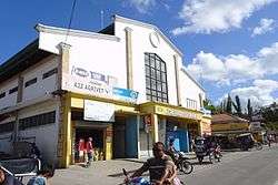
Alcantara public market
References
- ↑ "Municipality". Quezon City, Philippines: Department of the Interior and Local Government. Retrieved 31 May 2013.
- ↑ "Province: Cebu". PSGC Interactive. Quezon City, Philippines: Philippine Statistics Authority. Retrieved 12 November 2016.
- 1 2 3 4 Census of Population (2015). "Region VII (Central Visayas)". Total Population by Province, City, Municipality and Barangay. PSA. Retrieved 20 June 2016.
- 1 2 Census of Population and Housing (2010). "Region VII (Central Visayas)". Total Population by Province, City, Municipality and Barangay. NSO. Retrieved 29 June 2016.
- ↑ Censuses of Population (1903–2007). "Region VII (Central Visayas)". Table 1. Population Enumerated in Various Censuses by Province/Highly Urbanized City: 1903 to 2007. NSO.
Places adjacent to Alcantara, Cebu | ||||||||||
|---|---|---|---|---|---|---|---|---|---|---|
| ||||||||||
Cebu City (capital) | |
| Municipalities |
|
| Component cities | |
| Highly urbanized cities | (Administratively independent from the province but grouped under Cebu by the Philippine Statistics Authority. However, qualified voters in Mandaue are allowed to vote in elections for Cebu provincial officials as part of the 6th Sangguniang Panlalawigan district.) |
This article is issued from
Wikipedia.
The text is licensed under Creative Commons - Attribution - Sharealike.
Additional terms may apply for the media files.