Barili
| Barili | |
|---|---|
| Municipality | |
| Municipality of Barili | |
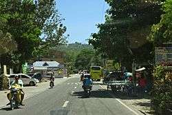 Poblacion | |
 Map of Cebu with Barili highlighted | |
.svg.png) Barili Location within the Philippines | |
| Coordinates: 10°07′N 123°32′E / 10.12°N 123.53°ECoordinates: 10°07′N 123°32′E / 10.12°N 123.53°E | |
| Country |
|
| Region | Central Visayas (Region VII) |
| Province | Cebu |
| District | 3rd district of Cebu |
| Founded | 1632 |
| Barangays | 42 (see Barangays) |
| Government [1] | |
| • Type | Sangguniang Bayan |
| • Mayor | Marlon Garcia |
| • Vice Mayor | Teresito Mariñas |
| • Congressman | Gwendolyn Garcia |
| • Electorate | 42,831 voters (2016) |
| Area [2] | |
| • Total | 122.21 km2 (47.19 sq mi) |
| Elevation | 45 m (148 ft) |
| Population (2015 census)[3] | |
| • Total | 73,862 |
| • Density | 600/km2 (1,600/sq mi) |
| Time zone | UTC+8 (PST) |
| ZIP code | 6036 |
| PSGC | 072210000 |
| IDD : area code | +63 (0)32 |
| Climate type | Tropical climate |
| Income class | 2nd municipal income class |
| Revenue (₱) | 145,272,827.87 (2016) |
| Native languages |
Cebuano Tagalog |
Barili, officially the Municipality of Barili, (Cebuano: Lungsod sa Barili; Tagalog: Bayan ng Barili), is a 2nd class municipality in the province of Cebu, Philippines. According to the 2015 census, it has a population of 73,862 people.[3]
Barili is bordered to the north by the town of Aloguinsan, to the west is the Tañon Strait, to the east is the city of Carcar and the town of Sibonga, and to the south is the town of Dumanjug.
History
The word barili comes from the name of a local grass called balili. The municipality was founded in 1632, though the parish of Barili was established in 1614. A cross was erected by conquistadores on their arrival at 1602, and still exists today.
It was in Barili that the Japanese forces captured Chief Justice Jose Abad Santos while on his way to Toledo as his escape route to Negros.
In 2006, the town became the first municipality in Cebu province to give protections to its heritage sites through Municipal Ordinance No. 04-06-01, s. 2006, declaring certain shrines, houses, buildings, monuments, markers and other areas as cultural properties of the municipality.
Barangays
Barili comprises 42 barangays:
| PSGC | Barangay | Population | ±% p.a. | |||
|---|---|---|---|---|---|---|
| 2015[3] | 2010[4] | |||||
| 072210001 | Azucena | 2.8% | 2,061 | 1,647 | 4.36% | |
| 072210002 | Bagakay | 1.2% | 904 | 824 | 1.78% | |
| 072210003 | Balao | 3.3% | 2,446 | 1,776 | 6.28% | |
| 072210004 | Bolocboloc | 3.0% | 2,226 | 1,932 | 2.73% | |
| 072210005 | Budbud | 2.2% | 1,628 | 1,513 | 1.40% | |
| 072210006 | Bugtong Kawayan | 1.1% | 800 | 719 | 2.05% | |
| 072210007 | Cabcaban | 2.6% | 1,922 | 1,543 | 4.27% | |
| 072210016 | Cagay | 2.5% | 1,813 | 1,568 | 2.80% | |
| 072210008 | Campangga | 2.0% | 1,455 | 1,481 | −0.34% | |
| 072210020 | Candugay | 2.4% | 1,777 | 1,443 | 4.04% | |
| 072210009 | Dakit | 2.5% | 1,864 | 1,672 | 2.09% | |
| 072210010 | Giloctog | 2.2% | 1,589 | 1,502 | 1.08% | |
| 072210012 | Giwanon | 2.5% | 1,830 | 1,608 | 2.49% | |
| 072210011 | Guibuangan | 3.1% | 2,303 | 2,212 | 0.77% | |
| 072210013 | Gunting | 3.9% | 2,861 | 2,566 | 2.09% | |
| 072210014 | Hilasgasan | 1.0% | 747 | 863 | −2.71% | |
| 072210015 | Japitan | 5.2% | 3,821 | 3,527 | 1.54% | |
| 072210017 | Kalubihan | 1.9% | 1,403 | 1,197 | 3.07% | |
| 072210018 | Kangdampas | 1.5% | 1,077 | 955 | 2.32% | |
| 072210021 | Luhod | 1.3% | 955 | 917 | 0.78% | |
| 072210022 | Lupo | 0.9% | 673 | 614 | 1.76% | |
| 072210023 | Luyo | 1.5% | 1,091 | 1,071 | 0.35% | |
| 072210024 | Maghanoy | 1.7% | 1,265 | 1,077 | 3.11% | |
| 072210025 | Maigang | 2.7% | 1,978 | 1,688 | 3.06% | |
| 072210026 | Malolos | 2.4% | 1,742 | 1,617 | 1.43% | |
| 072210027 | Mantalongon | 4.0% | 2,988 | 2,566 | 2.94% | |
| 072210028 | Mantayupan | 3.1% | 2,317 | 2,092 | 1.96% | |
| 072210029 | Mayana | 1.7% | 1,250 | 1,075 | 2.91% | |
| 072210030 | Minolos | 3.2% | 2,399 | 2,311 | 0.71% | |
| 072210031 | Nabunturan | 1.0% | 774 | 684 | 2.38% | |
| 072210032 | Nasipit | 1.6% | 1,172 | 1,030 | 2.49% | |
| 072210034 | Pancil | 1.6% | 1,153 | 890 | 5.05% | |
| 072210035 | Pangpang | 1.3% | 995 | 853 | 2.98% | |
| 072210036 | Paril | 1.7% | 1,241 | 1,137 | 1.68% | |
| 072210037 | Patupat | 2.5% | 1,850 | 1,663 | 2.05% | |
| 072210038 | Poblacion | 7.0% | 5,141 | 4,808 | 1.28% | |
| 072210039 | San Rafael | 2.2% | 1,654 | 1,157 | 7.04% | |
| 072210040 | Santa Ana | 2.8% | 2,087 | 2,045 | 0.39% | |
| 072210041 | Sayaw | 1.8% | 1,298 | 1,090 | 3.38% | |
| 072210042 | Tal‑ot | 2.5% | 1,876 | 1,639 | 2.60% | |
| 072210043 | Tubod | 2.9% | 2,176 | 1,889 | 2.73% | |
| 072210044 | Vito | 1.7% | 1,260 | 1,063 | 3.29% | |
| Total | 73,862 | 65,524 | 2.31% | |||
Demographics
| Population census of Barili | ||
|---|---|---|
| Year | Pop. | ±% p.a. |
| 1903 | 31,617 | — |
| 1918 | 33,481 | +0.38% |
| 1939 | 29,247 | −0.64% |
| 1948 | 27,267 | −0.78% |
| 1960 | 28,656 | +0.41% |
| 1970 | 34,714 | +1.93% |
| 1975 | 36,286 | +0.89% |
| 1980 | 39,560 | +1.74% |
| 1990 | 47,789 | +1.91% |
| 1995 | 52,060 | +1.62% |
| 2000 | 57,764 | +2.25% |
| 2007 | 60,430 | +0.62% |
| 2010 | 65,524 | +2.99% |
| 2015 | 73,862 | +2.31% |
| Source: Philippine Statistics Authority[3] [4] [5] [6] | ||
Economy
The economic output of Barili is mainly rice, maize, bananas, vegetables and coconuts.
Tourism
Mantayupan Falls are located close to the eastern end of the Carcar—Barili Road where it connects to the national highway.[7] The falls are approximately 61 metres (200 ft) high but do not have a direct descent. Pools at various heights flow into the basin. The waterfall is one of three main tourist attractions in the interior barangays of Barili.[8]
Gallery
 Mantayupan Falls
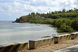 Tañon Strait coast at Barili
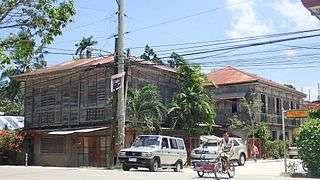 Historic houses in Barili
See also
References
- ↑ "Municipality". Quezon City, Philippines: Department of the Interior and Local Government. Retrieved 31 May 2013.
- ↑ "Province: Cebu". PSGC Interactive. Quezon City, Philippines: Philippine Statistics Authority. Retrieved 12 November 2016.
- 1 2 3 4 Census of Population (2015). "Region VII (Central Visayas)". Total Population by Province, City, Municipality and Barangay. PSA. Retrieved 20 June 2016.
- 1 2 Census of Population and Housing (2010). "Region VII (Central Visayas)". Total Population by Province, City, Municipality and Barangay. NSO. Retrieved 29 June 2016.
- ↑ Censuses of Population (1903–2007). "Region VII (Central Visayas)". Table 1. Population Enumerated in Various Censuses by Province/Highly Urbanized City: 1903 to 2007. NSO.
- ↑ "Province of Cebu". Municipality Population Data. Local Water Utilities Administration Research Division. Retrieved 17 December 2016.
- ↑ 10°6′24″N 123°31′16″E / 10.10667°N 123.52111°E
- ↑ Cabigas 2011.
Sources
- Cabigas, Estan (29 September 2011), "Visiting Mantayupan Falls after 23 years" (Photographic essay), Langyaw, archived from the original on 1 October 2011, retrieved 12 February 2015
- Pace, Azucena (2009). Barili The Town The People The Years, A History. Cebu: Local Government Unit of Barili, Cebu. ISBN 978-9719441601.
| Wikimedia Commons has media related to Barili. |
External links
Places adjacent to Barili | ||||||||||
|---|---|---|---|---|---|---|---|---|---|---|
| ||||||||||
Cebu City (capital) | |
| Municipalities |
|
| Component cities | |
| Highly urbanized cities | (Administratively independent from the province but grouped under Cebu by the Philippine Statistics Authority. However, qualified voters in Mandaue are allowed to vote in elections for Cebu provincial officials as part of the 6th Sangguniang Panlalawigan district.) |