Sulakyurt
| Sulakyurt | |
|---|---|
| District | |
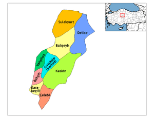 Location of Sulakyurt within Turkey. | |
 Sulakyurt Location of Sulakyurt within Turkey. | |
| Coordinates: 40°09′N 33°43′E / 40.150°N 33.717°E | |
| Country |
|
| Province | Kırıkkale |
| Government | |
| • Mayor | Ali Şahin (AKP) |
| Area[1] | |
| • District | 753.90 km2 (291.08 sq mi) |
| Elevation | 834 m (2,736 ft) |
| Population (2012)[2] | |
| • Urban | 2,582 |
| • District | 9,783 |
| • District density | 13/km2 (34/sq mi) |
| Time zone | UTC+2 (EET) |
| • Summer (DST) | UTC+3 (EEST) |
| Postal code | 71xxx |
| Area code(s) | 0318 |
| Licence plate | 71 |
| Climate | Csb |
| Website | www.sulakyurt.gov.tr |
Sulakyurt is a town and district of Kırıkkale Province in the Central Anatolia region of Turkey. At the 2000 Turkish census, the population of the district was 16,480, of whom 6,344 lived in the town of Sulakyurt.[3]
Notes
- ↑ "Area of regions (including lakes), km²". Regional Statistics Database. Turkish Statistical Institute. 2002. Retrieved 2013-03-05.
- ↑ "Population of province/district centers and towns/villages by districts - 2012". Address Based Population Registration System (ABPRS) Database. Turkish Statistical Institute. Retrieved 2013-02-27.
- ↑ Turkish Statistical Institute. "Census 2000, Key statistics for urban areas of Turkey" (in Turkish). Archived from the original (XLS) on 2007-07-22. Retrieved 2008-03-20.
References
- Falling Rain Genomics, Inc. "Geographical information on Sulakyurt, Turkey". Retrieved 2008-03-16.
External links
- District governor's official website (in Turkish)
- District municipality's official website (in Turkish)
Coordinates: 40°09′27″N 33°43′03″E / 40.15750°N 33.71750°E
This article is issued from
Wikipedia.
The text is licensed under Creative Commons - Attribution - Sharealike.
Additional terms may apply for the media files.