Sloupnice
| Sloupnice | |||
| Village | |||
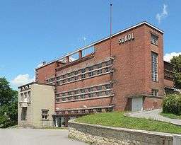 Sokol | |||
|
|||
| Country | Czech Republic | ||
|---|---|---|---|
| Region | Pardubice | ||
| District | Svitavy | ||
| Little District | Litomyšl | ||
| Elevation | 390 m (1,280 ft) | ||
| Coordinates | 49°55′N 16°19′E / 49.917°N 16.317°ECoordinates: 49°55′N 16°19′E / 49.917°N 16.317°E | ||
| Area | 27.91 km2 (10.78 sq mi) | ||
| Population | 1,697 (1.1.2014) | ||
| Density | 61/km2 (158/sq mi) | ||
| First mentioned | 1292 | ||
| Mayor | Josef Škeřík | ||
| Timezone | CET (UTC+1) | ||
| - summer (DST) | CEST (UTC+2) | ||
| Postal code | 565 53 | ||
  Location in the Czech Republic | |||
| Wikimedia Commons: Sloupnice | |||
| Website: www.sloupnice.cz | |||
Sloupnice is a large village in the Svitavy District (until January 1, 2007, in the Ústí nad Orlicí District) of the Pardubice Region in the northeast of Bohemia, Czech Republic. It lies in the north of Svitavy District, near the border of Ústí nad Orlicí District. The village is surrounded by five towns: Litomyšl - the nearest one, Ústí nad Orlicí, Česká Třebová, Vysoké Mýto and Choceň.
Topography
Sloupnice is linear village formed around the east-west road connecting towns Ústí nad Orlicí and Vysoké Mýto. Although the length of the village along the road is approximately 6.5 km, the width of village is up to 500 m. The bus station in the middle of the village is the only open space area that can be considered as a village square or village green. The brook of Bílá Labuť (White Swan in English) flows close to the major road in the lower based two-thirds of village.
Administrative division and local names
For the purpose of the law (land register, election, etc.) the village is divided in following parts:
- Dolní Sloupnice (Lower Sloupnice), with the hamlet of Džbánovec
- Horní Sloupnice (Upper Sloupnice)
- Končiny 1st part (Parts)
- Končiny 2nd part (Parts)
Some parts of central village (i.e. Dolní Sloupnice and Horní Sloupnice) have their folk names. These names are used at village council meeting as well.
- Vesnička (Small Village) - group of houses in the north-east part of the village with the highest altitude, part of Horní Sloupnice
- Rafanda (untranslatable) - single-family house group located in the middle of Horní Sloupnice, pretty new part of the village
- humna (pl.,untranslatable) - general term for east-west village zones situated close to surrounding fields (i.e. houses that are not situated along the major road or along the local brook Bílá Labuť)
Name
The word Sloupnice cannot be directly translated into English. It probably originates from the word slup that was a cage used in fishery. On historical maps the village can be found as Sloupnitz with parts Ober Slupnitz (Upper Sloupnitz) and Unter Sloupnitz (Lower Sloupnitz). The name of Džbánovec is diminutive name derived from geographical name Džbánov (Džbánov is neighbour village to Sloupnice). The name of Džbánov was probably derived from the Old Czech name Čbán.[1]
Local area significancy
The village of Sloupnice is a local area centre. Health centre, primary school (basic school), kindergarten and post office are located there. Especially the health centre and primary school is used by other villages inhabitants (e.g. villages České Heřmanice, Džbánov, Horky, Voděrady).
Adjacent villages
References
- ↑ Sloupnice's name origin, website of the microregion Orlicko-Třebovsko, 7 August 2007 (Czech)
External links
- official Sloupnice website (Czech)
See also
| Wikimedia Commons has media related to Sloupnice. |