Bohuňov (Svitavy District)
| Bohuňov | |||
|---|---|---|---|
| Municipality | |||
 | |||
| |||
 Bohuňov | |||
| Coordinates: 49°35′50″N 16°27′57″E / 49.59722°N 16.46583°ECoordinates: 49°35′50″N 16°27′57″E / 49.59722°N 16.46583°E | |||
| Country |
| ||
| Region | Pardubice | ||
| District | Svitavy | ||
| Area | |||
| • Total | 2.89 km2 (1.12 sq mi) | ||
| Elevation | 398 m (1,306 ft) | ||
| Population (2006) | |||
| • Total | 168 | ||
| • Density | 58/km2 (150/sq mi) | ||
| Postal code | 569 04 | ||
_-_vlajka.jpg)
.png)
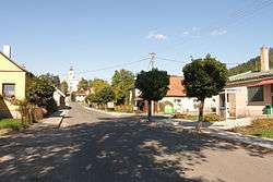
Bohuňov is a village and municipality (obec) in Svitavy District in the Pardubice Region of the Czech Republic.
The municipality covers an area of 2.89 square kilometres (1.12 sq mi), and has a population of 168 (as at 2 October 2006).
Bohuňov lies approximately 18 kilometres (11 mi) south of Svitavy, 70 km (43 mi) south-east of Pardubice, and 157 km (98 mi) east of Prague.
References
| Wikimedia Commons has media related to Bohuňov (Svitavy District). |
This article is issued from
Wikipedia.
The text is licensed under Creative Commons - Attribution - Sharealike.
Additional terms may apply for the media files.