Příluka
| Příluka | |||
|---|---|---|---|
| Municipality | |||
 | |||
| |||
 Příluka | |||
| Coordinates: 49°52′3″N 16°9′39″E / 49.86750°N 16.16083°ECoordinates: 49°52′3″N 16°9′39″E / 49.86750°N 16.16083°E | |||
| Country |
| ||
| Region | Pardubice | ||
| District | Svitavy | ||
| Area | |||
| • Total | 3.81 km2 (1.47 sq mi) | ||
| Elevation | 455 m (1,493 ft) | ||
| Population (1.1.12014) | |||
| • Total | 172 | ||
| • Density | 45/km2 (120/sq mi) | ||
| Postal code | 539 44 | ||
| Website | http://priluka.infobec.cz | ||
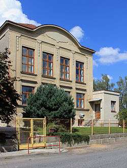
Příluka is a village and municipality (obec) in Svitavy District in the Pardubice Region of the Czech Republic.
The municipality covers an area of 3.81 square kilometres (1.47 sq mi), and has a population of 162 (as at 2 October 2006).
Příluka lies approximately 26 kilometres (16 mi) north-west of Svitavy, 34 km (21 mi) south-east of Pardubice, and 127 km (79 mi) east of Prague.
References
| Wikimedia Commons has media related to Příluka. |
This article is issued from
Wikipedia.
The text is licensed under Creative Commons - Attribution - Sharealike.
Additional terms may apply for the media files.