Slapy (Tábor District)
| Slapy | |||
|---|---|---|---|
| Municipality | |||
 | |||
| |||
 Slapy | |||
| Coordinates: 49°23′15″N 14°36′58″E / 49.38750°N 14.61611°ECoordinates: 49°23′15″N 14°36′58″E / 49.38750°N 14.61611°E | |||
| Country |
| ||
| Region | South Bohemian | ||
| District | Tábor | ||
| Area | |||
| • Total | 6.32 km2 (2.44 sq mi) | ||
| Elevation | 500 m (1,600 ft) | ||
| Population (2006) | |||
| • Total | 464 | ||
| • Density | 73/km2 (190/sq mi) | ||
| Postal code | 391 11 to 391 76 | ||
| Website | http://www.obecslapy.cz | ||


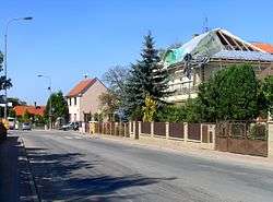
Slapy is a village and municipality (obec) in Tábor District in the South Bohemian Region of the Czech Republic.
The municipality covers an area of 6.32 square kilometres (2.44 sq mi), and has a population of 464 (as at 28 August 2006).
Slapy lies approximately 5 kilometres (3 mi) south-west of Tábor, 47 km (29 mi) north of České Budějovice, and 79 km (49 mi) south of Prague.
References
| Wikimedia Commons has media related to Slapy (Tábor District). |
This article is issued from
Wikipedia.
The text is licensed under Creative Commons - Attribution - Sharealike.
Additional terms may apply for the media files.