Haškovcova Lhota
| Haškovcova Lhota | |
|---|---|
| Municipality | |
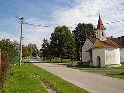 Chapel in the village | |
 Haškovcova Lhota | |
| Coordinates: 49°19′47″N 14°27′57″E / 49.32972°N 14.46583°ECoordinates: 49°19′47″N 14°27′57″E / 49.32972°N 14.46583°E | |
| Country |
|
| Region | South Bohemian |
| District | Tábor |
| Area | |
| • Total | 3.03 km2 (1.17 sq mi) |
| Elevation | 417 m (1,368 ft) |
| Population (2006) | |
| • Total | 74 |
| • Density | 24/km2 (63/sq mi) |
| Postal code | 391 65 |
Haškovcova Lhota is a village and municipality (obec) in Tábor District in the South Bohemian Region of the Czech Republic.
The municipality covers an area of 3.03 square kilometres (1.17 sq mi), and has a population of 73 (as 2017).
Haškovcova Lhota lies approximately 17 kilometres (11 mi) south-west of Tábor, 40 km (25 mi) north of České Budějovice, and 85 km (53 mi) south of Prague.
References
This article is issued from
Wikipedia.
The text is licensed under Creative Commons - Attribution - Sharealike.
Additional terms may apply for the media files.