Ratibořské Hory
| Ratibořské Hory | |
|---|---|
| Municipality | |
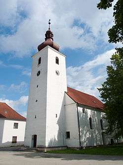 Saint Adalbert Church | |
 Ratibořské Hory | |
| Coordinates: 49°27′45″N 14°46′12″E / 49.46250°N 14.77000°ECoordinates: 49°27′45″N 14°46′12″E / 49.46250°N 14.77000°E | |
| Country |
|
| Region | South Bohemian |
| District | Tábor |
| Area | |
| • Total | 21.13 km2 (8.16 sq mi) |
| Elevation | 418 m (1,371 ft) |
| Population (2006) | |
| • Total | 747 |
| • Density | 35/km2 (92/sq mi) |
| Postal code | 391 42 to 391 43 |
Ratibořské Hory (German: Bergstädtel) is a village and municipality (obec) in Tábor District in the South Bohemian Region of the Czech Republic.
The municipality covers an area of 21.13 square kilometres (8.16 sq mi), and has a population of 747 (as at 2 October 2006).
Ratibořské Hory lies approximately 10 kilometres (6 mi) north-east of Tábor, 59 km (37 mi) north of České Budějovice, and 74 km (46 mi) south of Prague.
References
| Wikimedia Commons has media related to Ratibořské Hory. |
This article is issued from
Wikipedia.
The text is licensed under Creative Commons - Attribution - Sharealike.
Additional terms may apply for the media files.