Sironko District
| Sironko District | |
|---|---|
| District | |
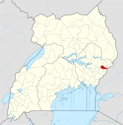 District location in Uganda | |
| Coordinates: 01°14′N 34°15′E / 1.233°N 34.250°ECoordinates: 01°14′N 34°15′E / 1.233°N 34.250°E | |
| Country |
|
| Region | Eastern Region |
| Sub-region | Bugisu sub-region |
| Capital | Sironko |
| Area | |
| • Land | 446.1 km2 (172.2 sq mi) |
| Elevation | 1,420 m (4,660 ft) |
| Population (2012 Estimate) | |
| • Total | 239,600 |
| • Density | 537.1/km2 (1,391/sq mi) |
| Time zone | UTC+3 (EAT) |
| Website |
www |
Sironko District is a district in the Eastern Region of Uganda. The district was created in 2000 and had previously been part of Mbale District. Sironko is the main commercial town in the district.
Location
Sironko District is bordered by Bulambuli District to the north, Kapchorwa and Kween Districts to the north-east, Kenya to the east, Bududa District to the south-east, Mbale District to south-west, and Bukedea District to the west. Sironko is approximately 22 kilometres (14 mi), by road, north-east of Mbale, the largest city in the Bugisu sub-region.[1]
Population
In 1991, the national population census estimated the district population at 147,700. The national census in 2002 estimated the population at 185,800, with an annual growth rate of 2.6 percent. The population in 2012 was estimated to be 239,600.[2]
Geography
The district has a total area of 446.1 square kilometres (172.2 sq mi).[3]
Major towns
Sironko is the largest town and the administrative headquarters. Mafuni, Nakaloke, Mutufu, and Budadiri are the main trading centers within the district.
Counties, sub-counties and constituencies
Economy
The primary activity is agriculture with a focus on food crops such as beans, groundnuts, sorghum, millet, cassava, potatoes and sweet potatoes. Coffee and cotton are the main cash crops. Fruits and vegetables grown in the district include passion fruit, tomatoes, onions and cabbage.[6]
Tourist attractions
Part of Mount Elgon National Park lies within Sironko district. One of the two main trails in the park, Sasa trail, starts near the Budadiri trading center located within the district.[7]
References
- ↑ "Map Showing Mbale And Sironko With Distance Marker". Globefeed.com. Retrieved 20 May 2014.
- ↑ "Estimated Population of Sironko District In 1991, 2002 & 2012". Citypopulation.de. Retrieved 20 May 2014.
- ↑ "Estimated Land Area In Sironko District". Citypopulation.de. 2012. Retrieved 20 May 2014.
- ↑ Districts of Uganda, Statoids, accessed 3 August 2015
- ↑ Counties of Uganda, Statoids, accessed 3 August 2015
- ↑ "Economic Activity In Sironko District". Uganda Travel Bureau. Retrieved 20 May 2014.
- ↑ Spectrum guide to Uganda, Interlink Books, 1998, p. 156. ISBN 1-56656-270-8.