Budadiri
| Budadiri | |
|---|---|
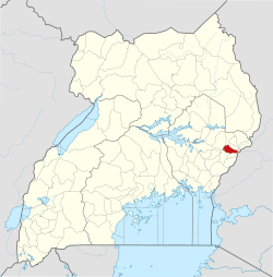
 Budadiri Location in Uganda | |
| Coordinates: 01°10′12″N 34°20′06″E / 1.17000°N 34.33500°ECoordinates: 01°10′12″N 34°20′06″E / 1.17000°N 34.33500°E | |
| Country |
|
| Region | Eastern Region |
| Sub-region | Bugisu sub-region |
| District | Sironko District |
| Elevation | 1,240 m (4,070 ft) |
| Time zone | UTC+3 (EAT) |
Budadiri is a town in eastern Uganda. It is one of the urban centers in Sironko District.
Location
Budadiri is located approximately 13 kilometres (8.1 mi), by road, southeast of Sironko, the district headquarters.[1] It is located within Mount Elgon National Park. The coordinates of the town are:10 10 12N, 34 20 06E (Latitude:1.1700; 34.3350).
Overview
Budadiri is situated at 1,240 metres (4,070 ft) above sea level, at the foothills of Mount Elgon. The town is a popular staging area and base camp for climbers who would like to scale the mountain.[2]
Population
The exact population of Budadiri is not known at this time.
Landmarks
The landmarks within the town limits or close to the edges of town include:
- The slopes and peak of Mount Elgon
- The offices of Mount Elgon National Park
- Rose's Last Chance - A seven-room bed and breakfast with secure parking space. Camping space is also available.
- Mere's Hotel - A safe, secure place to secure accommodation and meals.
- Nabunubi's - A non-expensive place to east. Located near the taxi park.
- Budadiri Taxi Park - A place where to find public transportation to Sironko, Mbale and beyond.
External links
See also
References
- ↑ Road distance between Sironko and Budadiri with Map
- ↑ Hodd, Michael; Roche, Angela (2002). Uganda Handbook. Footprint Handbooks. ISBN 9781903471340.
Capital: Sironko | ||
| Counties and sub-counties |
|  |
| Towns and villages | ||
| Geography | ||
| Economy | ||
| Transport |
| |
| Notable landmarks | ||
| Notable people | ||
This article is issued from
Wikipedia.
The text is licensed under Creative Commons - Attribution - Sharealike.
Additional terms may apply for the media files.