Tororo District
| Tororo District | |
|---|---|
| District | |
 Sukulu complex | |
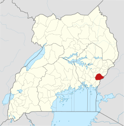 District location in Uganda | |
| Coordinates: 00°45′N 34°05′E / 0.750°N 34.083°ECoordinates: 00°45′N 34°05′E / 0.750°N 34.083°E | |
| Country |
|
| Region | Eastern Region |
| Capital | Tororo |
| Area | |
| • Land | 1,196.4 km2 (461.9 sq mi) |
| Population (2012 Estimate) | |
| • Total | 487,900 |
| • Density | 407.8/km2 (1,056/sq mi) |
| Time zone | UTC+3 (EAT) |
| Website |
www |
Tororo District is a district in the Eastern Region of Uganda. The town of Tororo hosts the district headquarters.
Location
Tororo District is bordered by Mbale District to the north, Manafwa District to the north-east, Kenya to the east, Busia District to the south, Bugiri District to the south-west, and Butaleja District to the north-west. Tororo, the largest town in the district and the location of the district headquarters, is approximately 230 kilometres (140 mi), east of Kampala, the capital and largest city of Uganda [1]
Population
In 1991, the national population census estimated the population of the district at 285,300. The 2002 national census estimated the population at 379,400, with an annual population growth rate of approximately 2.7 percent. In 2012, the mid-year population was estimated at 487,900.[2]
Economic activities
Agriculture is the backbone of the district economy. Most of the district produce is consumed locally or sold in the urban areas within the district. Crops grown include the following:[3]
References
- ↑ "Map Showing Kampala And Tororo With Distance Marker". Globefeed.com. Retrieved 9 May 2014.
- ↑ "Estimated Population of Tororo District In 1991, 2002 & 2012". Citypopulation.de. Retrieved 9 May 2014.
- ↑ "Profile of Tororo District". Uganda Travel Guide. Retrieved 9 May 2014.