Scottsville, Kansas
| Scottsville, Kansas | |
|---|---|
| City | |
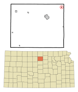 Location within Mitchell County and Kansas | |
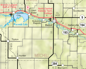 KDOT map of Mitchell County (legend) | |
| Coordinates: 39°32′34″N 97°57′13″W / 39.54278°N 97.95361°WCoordinates: 39°32′34″N 97°57′13″W / 39.54278°N 97.95361°W | |
| Country | United States |
| State | Kansas |
| County | Mitchell |
| Area[1] | |
| • Total | 0.25 sq mi (0.65 km2) |
| • Land | 0.25 sq mi (0.65 km2) |
| • Water | 0 sq mi (0 km2) |
| Elevation | 1,562 ft (476 m) |
| Population (2010)[2] | |
| • Total | 25 |
| • Estimate (2016)[3] | 24 |
| • Density | 100/sq mi (38/km2) |
| Time zone | UTC-6 (Central (CST)) |
| • Summer (DST) | UTC-5 (CDT) |
| ZIP code | 67420 |
| Area code | 785 |
| FIPS code | 20-63650 [4] |
| GNIS ID | 0484934 [5] |
Scottsville is a city in Mitchell County, Kansas, United States. As of the 2010 census, the city population was 25.[6]
History
Scottsville was platted in October 1878 when the railroad was extended to that point.[7][8] It was named for Tom Scott, a pioneer settler.[9][10]
The post office in Scottsville was discontinued in 1967.[11]
Geography
Scottsville is located at 39°32′34″N 97°57′13″W / 39.54278°N 97.95361°W (39.542783, -97.953746).[12] According to the United States Census Bureau, the city has a total area of 0.25 square miles (0.65 km2), all of it land.[1]
Demographics
| Historical population | |||
|---|---|---|---|
| Census | Pop. | %± | |
| 1880 | 95 | — | |
| 1910 | 248 | — | |
| 1920 | 165 | −33.5% | |
| 1930 | 169 | 2.4% | |
| 1940 | 187 | 10.7% | |
| 1950 | 108 | −42.2% | |
| 1960 | 60 | −44.4% | |
| 1970 | 46 | −23.3% | |
| 1980 | 56 | 21.7% | |
| 1990 | 26 | −53.6% | |
| 2000 | 21 | −19.2% | |
| 2010 | 25 | 19.0% | |
| Est. 2016 | 24 | [3] | −4.0% |
| U.S. Decennial Census | |||
2010 census
As of the census[2] of 2010, there were 25 people, 11 households, and 7 families residing in the city. The population density was 100.0 inhabitants per square mile (38.6/km2). There were 15 housing units at an average density of 60.0 per square mile (23.2/km2). The racial makeup of the city was 96.0% White and 4.0% from two or more races.
There were 11 households of which 27.3% had children under the age of 18 living with them, 63.6% were married couples living together, and 36.4% were non-families. 36.4% of all households were made up of individuals and 18.2% had someone living alone who was 65 years of age or older. The average household size was 2.27 and the average family size was 3.00.
The median age in the city was 40.8 years. 28% of residents were under the age of 18; 0.0% were between the ages of 18 and 24; 28% were from 25 to 44; 36% were from 45 to 64; and 8% were 65 years of age or older. The gender makeup of the city was 56.0% male and 44.0% female.
2000 census
As of the census[4] of 2000, there were 21 people, 8 households, and 7 families residing in the city. The population density was 83.9 people per square mile (32.4/km²). There were 12 housing units at an average density of 48.0 per square mile (18.5/km²). The racial makeup of the city was 90.48% White, and 9.52% from two or more races.
There were 8 households out of which 50.0% had children under the age of 18 living with them, 75.0% were married couples living together, and 12.5% were non-families. 12.5% of all households were made up of individuals and none had someone living alone who was 65 years of age or older. The average household size was 2.63 and the average family size was 2.86.
In the city, the population was spread out with 23.8% under the age of 18, 14.3% from 18 to 24, 28.6% from 25 to 44, 14.3% from 45 to 64, and 19.0% who were 65 years of age or older. The median age was 40 years. For every 100 females, there were 133.3 males. For every 100 females age 18 and over, there were 166.7 males.
The median income for a household in the city was $28,750, and the median income for a family was $38,333. Males had a median income of $26,250 versus $11,250 for females. The per capita income for the city was $13,624. None of the population and none of the families were below the poverty line.
References
- 1 2 "US Gazetteer files 2010". United States Census Bureau. Archived from the original on 2012-01-24. Retrieved 2012-07-06.
- 1 2 "American FactFinder". United States Census Bureau. Retrieved 2012-07-06.
- 1 2 "Population and Housing Unit Estimates". Retrieved June 9, 2017.
- 1 2 "American FactFinder". United States Census Bureau. Retrieved 2008-01-31.
- ↑ "US Board on Geographic Names". United States Geological Survey. 2007-10-25. Retrieved 2008-01-31.
- ↑ "2010 City Population and Housing Occupancy Status". U.S. Census Bureau. Retrieved October 10, 2011.
- ↑ Kansas State Historical Society (1916). Biennial Report of the Board of Directors of the Kansas State Historical Society. Kansas State Printing Plant. p. 241.
- ↑ Blackmar, Frank Wilson (1912). Kansas: A Cyclopedia of State History, Volume 2. Standard Publishing Company. p. 656.
- ↑ Heim, Michael (2007). Exploring Kansas Highways. p. 79.
- ↑ "Profile for Scottsville, Kansas". ePodunk. Retrieved 16 June 2014.
- ↑ "Kansas Post Offices, 1828-1961 (archived)". Kansas Historical Society. Archived from the original on October 9, 2013. Retrieved 15 June 2014.
- ↑ "US Gazetteer files: 2010, 2000, and 1990". United States Census Bureau. 2011-02-12. Retrieved 2011-04-23.
External links
| Wikimedia Commons has media related to Scottsville, Kansas. |
- City
- Schools
- USD 273, local school district
- Maps
- Scottsville City Map, KDOT
Municipalities and communities of Mitchell County, Kansas, United States | ||
|---|---|---|
| Cities | 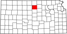 | |
| CDP | ||
| Unincorporated community | ||
| Ghost towns | ||
| Townships |
| |
| Footnotes | ‡This populated place also has portions in an adjacent county or counties | |