Clyde, Kansas
| Clyde, Kansas | |
|---|---|
| City | |
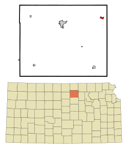 Location within Cloud County and Kansas | |
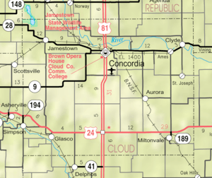 KDOT map of Cloud County (legend) | |
| Coordinates: 39°35′30″N 97°23′52″W / 39.59167°N 97.39778°WCoordinates: 39°35′30″N 97°23′52″W / 39.59167°N 97.39778°W | |
| Country | United States |
| State | Kansas |
| County | Cloud |
| Government | |
| • Type | Mayor–Council |
| Area[1] | |
| • Total | 0.67 sq mi (1.74 km2) |
| • Land | 0.67 sq mi (1.74 km2) |
| • Water | 0 sq mi (0 km2) |
| Elevation | 1,296 ft (395 m) |
| Population (2010)[2] | |
| • Total | 716 |
| • Estimate (2016)[3] | 684 |
| • Density | 1,100/sq mi (410/km2) |
| Time zone | UTC-6 (CST) |
| • Summer (DST) | UTC-5 (CDT) |
| ZIP code | 66938 |
| Area code | 785 |
| FIPS code | 20-14475 [4] |
| GNIS ID | 473351 [5] |
| Website | ClydeKansas.org |
Clyde is a city in Cloud County, Kansas, United States. As of the 2010 census, the city population was 716.[6]
History
Clyde was laid out in 1867, making it the oldest town in Cloud County.[7][8] It was named after the River Clyde, in Scotland.[9][10][11] According to another source, it was named for Clyde, Ohio[12] (which also is named indirectly for the River Clyde.)
Clyde experienced growth in 1877 when the Central Branch Railroad was built through it.[13]
Geography
Clyde is located at 39°35′30″N 97°23′52″W / 39.59167°N 97.39778°W (39.591694, -97.397833).[14] According to the United States Census Bureau, the city has a total area of 0.67 square miles (1.74 km2), all of it land.[1]
Demographics
| Historical population | |||
|---|---|---|---|
| Census | Pop. | %± | |
| 1880 | 956 | — | |
| 1890 | 1,137 | 18.9% | |
| 1900 | 1,157 | 1.8% | |
| 1910 | 1,057 | −8.6% | |
| 1920 | 1,063 | 0.6% | |
| 1930 | 1,174 | 10.4% | |
| 1940 | 1,060 | −9.7% | |
| 1950 | 1,067 | 0.7% | |
| 1960 | 1,025 | −3.9% | |
| 1970 | 946 | −7.7% | |
| 1980 | 909 | −3.9% | |
| 1990 | 793 | −12.8% | |
| 2000 | 740 | −6.7% | |
| 2010 | 716 | −3.2% | |
| Est. 2016 | 684 | [3] | −4.5% |
| U.S. Decennial Census | |||
2010 census
As of the census[2] of 2010, there were 716 people, 297 households, and 194 families residing in the city. The population density was 1,068.7 inhabitants per square mile (412.6/km2). There were 370 housing units at an average density of 552.2 per square mile (213.2/km2). The racial makeup of the city was 97.8% White, 0.3% African American, 0.3% Asian, 0.3% from other races, and 1.4% from two or more races. Hispanic or Latino of any race were 0.7% of the population.
There were 297 households of which 26.9% had children under the age of 18 living with them, 56.6% were married couples living together, 4.0% had a female householder with no husband present, 4.7% had a male householder with no wife present, and 34.7% were non-families. 30.3% of all households were made up of individuals and 17.9% had someone living alone who was 65 years of age or older. The average household size was 2.31 and the average family size was 2.90.
The median age in the city was 46.7 years. 22.8% of residents were under the age of 18; 6.6% were between the ages of 18 and 24; 19% were from 25 to 44; 25.1% were from 45 to 64; and 26.5% were 65 years of age or older. The gender makeup of the city was 47.9% male and 52.1% female.
2000 census
As of the census[4] of 2000, there were 740 people, 319 households, and 200 families residing in the city. The population density was 1,101.4 people per square mile (426.4/km²). There were 377 housing units at an average density of 561.1 per square mile (217.3/km²). The racial makeup of the city was 99.73% White and 0.27% Native American. Hispanic or Latino of any race were 0.27% of the population.
There were 319 households out of which 25.7% had children under the age of 18 living with them, 57.1% were married couples living together, 4.1% had a female householder with no husband present, and 37.0% were non-families. 34.8% of all households were made up of individuals and 24.5% had someone living alone who was 65 years of age or older. The average household size was 2.23 and the average family size was 2.88.
In the city, the age distribution of the population shows 23.1% under the age of 18, 6.6% from 18 to 24, 20.1% from 25 to 44, 20.3% from 45 to 64, and 29.9% who were 65 years of age or older. The median age was 45 years. For every 100 females, there were 85.9 males. For every 100 females age 18 and over, there were 82.4 males.
The median income for a household in the city was $31,343, and the median income for a family was $39,167. Males had a median income of $29,286 versus $19,063 for females. The per capita income for the city was $17,852. About 1.0% of families and 4.5% of the population were below the poverty line, including 3.9% of those under age 18 and 8.3% of those age 65 or over.
Education
Clyde is part of the Clifton-Clyde Unified School District 224.[15] The school district includes Clifton, Clyde, Vining, Ames, St. Joseph, and nearby rural areas of Clay, Cloud, Washington counties. The district has three schools:
- Clifton-Clyde Senior High School, located in Clyde.
- Clifton-Clyde Middle School, located in Clifton.
- Clifton-Clyde Grade School, located in Clifton.
The Clifton-Clyde High School mascot is Eagles. Prior to school unification in 1981, the Clyde High School mascot was Bluejays.[16]
The Clyde Bluejays won the Kansas State High School 1A Football championship in 1977[17] and the boys 1A Basketball championship in 1979.[18]
Notable people
- George Dockins, Major League Baseball pitcher for the St. Louis Cardinals (1945) and Brooklyn Dodgers (1947).
- Louis M. Mollier (1846–1911), pioneer Roman Catholic priest for the Vicariate of Kansas (1874–1876), Diocese of Leavenworth (1877–1887), and Diocese of Concordia (later Salina) (1887–1911).[19][20]
See also
- National Register of Historic Places listings in Cloud County, Kansas
- Charles W. Van De Mark House – currently a private residence, is listed on the National Register of Historic Places
- Central Branch Union Pacific Railroad
- Concordia Blade-Empire
References
- 1 2 "US Gazetteer files 2010". United States Census Bureau. Archived from the original on 2012-06-26. Retrieved 2012-07-06.
- 1 2 "American FactFinder". United States Census Bureau. Retrieved 2012-07-06.
- 1 2 "Population and Housing Unit Estimates". Retrieved June 9, 2017.
- 1 2 "American FactFinder". United States Census Bureau. Archived from the original on 2013-09-11. Retrieved 2008-01-31.
- ↑ "US Board on Geographic Names". United States Geological Survey. 2007-10-25. Retrieved 2008-01-31.
- ↑ "2010 City Population and Housing Occupancy Status". U.S. Census Bureau. Archived from the original on July 21, 2011. Retrieved July 31, 2011.
- ↑ Blackmar, Frank Wilson (1912). Kansas: A Cyclopedia of State History, Embracing Events, Institutions, Industries, Counties, Cities, Towns, Prominent Persons, Etc. Standard Publishing Company. p. 376.
- ↑ "Cloud County". Blue Skyways. Kansas State Library. Retrieved 7 June 2014.
- ↑ Kansas State Historical Society (1916). Biennial Report of the Board of Directors of the Kansas State Historical Society. Kansas State Printing Plant. p. 163.
- ↑ Hollibaugh, E. F. (1903). Biographical History of Cloud County, Kansas: Biographies of Representative Citizens. Illustrated with Portraits of Prominent People, Cuts of Homes, Stock, Etc. Wilson, Humphrey & Company. p. 398.
- ↑ "Profile for Clyde, Kansas". ePodunk. Retrieved 7 June 2014.
- ↑ Kansas Place-Names, John Rydjord, University of Oklahoma Press, 1972, p. 273 ISBN 0-8061-0994-7
- ↑ Hollibaugh, E. F. (1903). Biographical History of Cloud County, Kansas: Biographies of Representative Citizens. Illustrated with Portraits of Prominent People, Cuts of Homes, Stock, Etc. Wilson, Humphrey & Company. p. 399.
- ↑ "US Gazetteer files: 2010, 2000, and 1990". United States Census Bureau. 2011-02-12. Retrieved 2011-04-23.
- ↑ USD 224
- ↑ "North Central Wins District", The Belleville Telescope, 8 March 1973, p.7.
- ↑ "Football". KSHSAA. Retrieved 3 January 2017.
- ↑ "Basketball". KSHSAA. Retrieved 3 January 2017.
- ↑ Sadliers' Catholic Directory, Almanac and Ordo. D. & J. Sadlier & Company. 1875-01-01.
- ↑ Hollibaugh, E. F. (1903-01-01). Biographical History of Cloud County, Kansas: Biographies of Representative Citizens. Illustrated with Portraits of Prominent People, Cuts of Homes, Stock, Etc. Wilson, Humphrey & Company.
External links
| Wikimedia Commons has media related to Clyde, Kansas. |
- City
- Schools
- Clifton-Clyde USD 224, local school district
- Historical
- Bob Condray – Museum of Toys on YouTube, from Hatteberg's People on KAKE TV news
- Maps
- Clyde City Map, KDOT
Municipalities and communities of Cloud County, Kansas, United States | ||
|---|---|---|
| Cities | 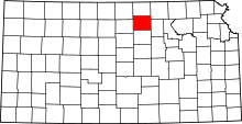 | |
| Unincorporated communities | ||
| Townships | ||
| Footnotes | ‡This populated place also has portions in an adjacent county or counties | |