Shire of Wangaratta (Victoria)
| Shire of Wangaratta Victoria | |||||||||||||||
|---|---|---|---|---|---|---|---|---|---|---|---|---|---|---|---|
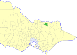 Location in Victoria | |||||||||||||||
| Population | 3,180 (1992)[1] | ||||||||||||||
| • Density | 3.459/km2 (8.960/sq mi) | ||||||||||||||
| Established | 1863 | ||||||||||||||
| Area | 919.24 km2 (354.9 sq mi) | ||||||||||||||
| Council seat | Wangaratta | ||||||||||||||
| County | Bogong, Moira | ||||||||||||||
| |||||||||||||||
The Shire of Wangaratta was a local government area about 260 kilometres (162 mi) northeast of Melbourne, the state capital of Victoria, Australia. The shire covered an area of 919.24 square kilometres (354.9 sq mi), and existed from 1863 until 1994. The Shire did not include Wangaratta itself, which was governed by a separate local government.
History
Wangaratta was first incorporated as the North Ovens Road District on 10 June 1863, which became a shire on 17 September 1867. Part of the Mokoan Riding of the Shire of Benalla was annexed as the Killawarra Riding on 31 May 1906. The shire was renamed Wangaratta on 22 November 1916.[2]
On 18 November 1994, the Shire was abolished, and merged with the City of Wangaratta, the Shire of Oxley and various surrounding districts into the Rural City of Wangaratta.[3]
Wards
Wangaratta was divided into four ridings, each of which elected three councillors:
- Boorhaman Riding
- Central Riding
- Killawarra Riding
- Tallawingee Riding
Towns and localities
- Boorhaman
- Boralma
- Bowser
- Eldorado
- Everton
- Killawarra
- Londrigan
- Peechelba
- Springhurst
- Tarrawingee
Population
| Year | Population |
|---|---|
| 1954 | 2,267 |
| 1958 | 2,320* |
| 1961 | 2,140 |
| 1966 | 1,952 |
| 1971 | 1,866 |
| 1976 | 2,266 |
| 1981 | 2,475 |
| 1986 | 3,039 |
| 1991 | 3,150 |
* Estimate in the 1958 Victorian Year Book.
References
- ↑ Australian Bureau of Statistics, Victoria Office (1994). Victorian Year Book. pp. 49–52. ISSN 0067-1223.
- ↑ Victorian Municipal Directory. Brunswick: Arnall & Jackson. 1992. p. 876. Accessed at State Library of Victoria, La Trobe Reading Room.
- ↑ Australian Bureau of Statistics (1 August 1995). Victorian local government amalgamations 1994-1995: Changes to the Australian Standard Geographical Classification (PDF). Commonwealth of Australia. p. 9. ISBN 0-642-23117-6. Retrieved 2008-01-05.