Rural City of Warragul
| Rural City of Warragul Victoria | |||||||||||||||
|---|---|---|---|---|---|---|---|---|---|---|---|---|---|---|---|
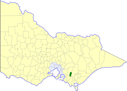 Location in Victoria | |||||||||||||||
| Population | 13,540 (1992)[1] | ||||||||||||||
| • Density | 38.444/km2 (99.57/sq mi) | ||||||||||||||
| Established | 1881 | ||||||||||||||
| Area | 352.2 km2 (136.0 sq mi) | ||||||||||||||
| Council seat | Warragul | ||||||||||||||
| County | Buln Buln | ||||||||||||||
 | |||||||||||||||
The Rural City of Warragul was a local government area about 100 kilometres (62 mi) east-southeast of Melbourne, the state capital of Victoria, Australia. The shire covered an area of 352.2 square kilometres (136.0 sq mi), and existed from 1881 until 1994.
History
Originally part of the Shire of Buln Buln, Warragul was first incorporated as a shire on 9 December 1881. It annexed part of the Western Riding of the Shire of Narracan on 30 May 1906. On 17 August 1990, Warragul was proclaimed a Rural City, one of the first in Victoria under the provisions of the Local Government Act 1989.[2]
On 2 December 1994, the Rural City of Warragul was abolished, and, along with the Shires of Buln Buln and Narracan, and parts of the Shire of Upper Yarra, was merged into the newly created Shire of Baw Baw.[3]
Wards
The Rural City of Warragul was divided into four wards, each of which elected three councillors:
- North Ward
- South Ward
- Central East Ward
- Central West Ward
Towns and localities
Population
| Year | Population |
|---|---|
| 1954 | 8,605 |
| 1958 | 9,450* |
| 1961 | 9,925 |
| 1966 | 9,925 |
| 1971 | 10,010 |
| 1976 | 10,377 |
| 1981 | 10,892 |
| 1986 | 11,748 |
| 1991 | 12,924 |
* Estimate in the 1958 Victorian Year Book.
References
- ↑ Australian Bureau of Statistics, Victoria Office (1994). Victorian Year Book. pp. 49–52. ISSN 0067-1223.
- ↑ Victorian Municipal Directory. Brunswick: Arnall & Jackson. 1992. pp. 514–515. Accessed at State Library of Victoria, La Trobe Reading Room.
- ↑ Australian Bureau of Statistics (1 August 1995). Victorian local government amalgamations 1994-1995: Changes to the Australian Standard Geographical Classification (PDF). Commonwealth of Australia. p. 4. ISBN 0-642-23117-6. Retrieved 2008-01-05.