Shire of Tambo (Victoria)
| Shire of Tambo Victoria | |||||||||||||||
|---|---|---|---|---|---|---|---|---|---|---|---|---|---|---|---|
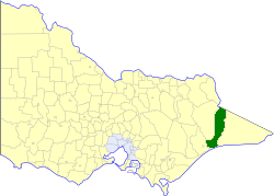 Location in Victoria | |||||||||||||||
| Population | 10,720 (1992)[1] | ||||||||||||||
| • Density | 3.0569/km2 (7.917/sq mi) | ||||||||||||||
| Established | 1882 | ||||||||||||||
| Area | 3,506.86 km2 (1,354.0 sq mi) | ||||||||||||||
| Council seat | Lakes Entrance | ||||||||||||||
| County | Dargo, Tambo | ||||||||||||||
| |||||||||||||||
The Shire of Tambo was a local government area about 320 kilometres (199 mi) east of Melbourne, the state capital of Victoria, Australia. The shire covered an area of 3,506.86 square kilometres (1,354.0 sq mi), and existed from 1882 until 1994.
History
Tambo was first incorporated as a shire on 6 January 1882, splitting away from the Shire of Bairnsdale. On 30 May 1892 it lost three-quarters of its land area when the Shire of Orbost was incorporated. A small amount was re-annexed as Cunninghame Riding on 3 January 1913.[2]
On 2 December 1994, the Shire was abolished, and merged with the City and Shire of Bairnsdale, Shire of Orbost, most of the Shire of Omeo and the Boole Boole Peninsula from Shire of Rosedale into the Shire of East Gippsland.[3]
Wards
Tambo was divided into four ridings, each of which elected three councillors:
- Bruthen/Buchan Riding
- Bumberrah Riding
- Coastal Riding
- Cunninghame Riding
Towns and localities
|
|
Population
| Year | Population |
|---|---|
| 1954 | 5,085 |
| 1958 | 5,490* |
| 1961 | 5,431 |
| 1966 | 5,441 |
| 1971 | 5,888 |
| 1976 | 6,336 |
| 1981 | 7,181 |
| 1986 | 8,941 |
| 1991 | 10,155 |
* Estimate in the 1958 Victorian Year Book.
References
- ↑ Australian Bureau of Statistics, Victoria Office (1994). Victorian Year Book. pp. 49–52. ISSN 0067-1223.
- ↑ Victorian Municipal Directory. Brunswick: Arnall & Jackson. 1992. pp. 855–856. Accessed at State Library of Victoria, La Trobe Reading Room.
- ↑ Australian Bureau of Statistics (1 August 1995). Victorian local government amalgamations 1994–1995: Changes to the Australian Standard Geographical Classification (PDF). Commonwealth of Australia. p. 6. ISBN 0-642-23117-6. Retrieved 5 January 2008.