Shire of McIvor
| Shire of McIvor Victoria | |||||||||||||||
|---|---|---|---|---|---|---|---|---|---|---|---|---|---|---|---|
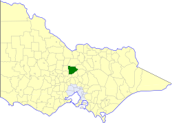 Location in Victoria | |||||||||||||||
| Population | 3,450 (1992)[1] | ||||||||||||||
| • Density | 2.664/km2 (6.900/sq mi) | ||||||||||||||
| Established | 1863 | ||||||||||||||
| Area | 1,295 km2 (500.0 sq mi) | ||||||||||||||
| Council seat | Heathcote | ||||||||||||||
| County | Dalhousie, Rodney | ||||||||||||||
| |||||||||||||||
The Shire of McIvor was a local government area about 110 kilometres (68 mi) north of Melbourne, the state capital of Victoria, Australia. The shire covered an area of 1,295 square kilometres (500.0 sq mi), and existed from 1863 until 1994.
History
McIvor was incorporated as a road district on 26 June 1863, and became a shire on 23 December 1864.
The Borough of Heathcote was created around the town of Heathcote in August 1869, but was reannexed as the Central Riding on 27 May 1892. Part of the East Riding was annexed to the Shire of Goulburn on 16 May 1956.[2]
On 18 November 1994, the Shire of McIvor was abolished, with most of its area, including Heathcote, transferring into the City of Greater Bendigo, which was created earlier in April 1994. The Graytown district was transferred into the newly created Shire of Strathbogie, while the Mia Mia and Tooborac districts were transferred into the newly created Shire of Mitchell.[3]
Wards
The Shire of McIvor was divided into four ridings on 16 May 1956, each of which elected three councillors:
- Centre Riding
- East Riding
- North West Riding
- South West Riding
Towns and localities
- Argyle
- Costerfield
- Derrinal
- Glenhope
- Graytown
- Heathcote
- Knowsley
- Mia Mia
- Redcastle
- Tooborac
Population
| Year | Population |
|---|---|
| 1954 | 2,201 |
| 1958 | 2,180* |
| 1961 | 2,140 |
| 1966 | 1,889 |
| 1971 | 1,789 |
| 1976 | 1,858 |
| 1981 | 2,140 |
| 1986 | 2,555 |
| 1991 | 3,182 |
* Estimate in the 1958 Victorian Year Book.
References
- ↑ Australian Bureau of Statistics, Victoria Office (1994). Victorian Year Book. p. 52. ISSN 0067-1223.
- ↑ Victorian Municipal Directory. Brunswick: Arnall & Jackson. 1992. pp. 778–779. Accessed at State Library of Victoria, La Trobe Reading Room.
- ↑ Australian Bureau of Statistics (1 August 1995). Victorian local government amalgamations 1994-1995: Changes to the Australian Standard Geographical Classification (PDF). Commonwealth of Australia. p. 6,9,11. ISBN 0-642-23117-6. Retrieved 2008-01-05.