Shire of Yarrawonga
| Shire of Yarrawonga Victoria | |||||||||||||||
|---|---|---|---|---|---|---|---|---|---|---|---|---|---|---|---|
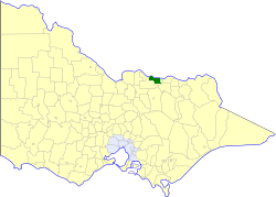 Location in Victoria | |||||||||||||||
| Population | 5,740 (1992)[1] | ||||||||||||||
| • Density | 9.158/km2 (23.719/sq mi) | ||||||||||||||
| Established | 1891 | ||||||||||||||
| Area | 626.78 km2 (242.0 sq mi) | ||||||||||||||
| Council seat | Yarrawonga | ||||||||||||||
| County | Moira | ||||||||||||||
| |||||||||||||||
The Shire of Yarrawonga was a local government area on the Murray River in the Goulburn Valley region about 260 kilometres (162 mi) northeast of Melbourne, the state capital of Victoria, Australia. The shire covered an area of 626.78 square kilometres (242.0 sq mi), and existed from 1891 until 1994.
History
Yarrawonga was once part of the vast Echuca Road District, formed in 1864 and a Shire from 1871, which extended along the south bank of the Murray River from Mount Hope Creek in the west to the Ovens River in the east.
Originally, Yarrawonga was part of the Shire of Tungamah, which, confusingly, was originally called the Shire of Yarrawonga when it first incorporated on 15 May 1878. On 17 April 1891, the East Riding, which contained the town of Yarrawonga, was severed and incorporated as the Shire of North Yarrawonga. After the original shire was renamed to Tungamah on 17 February 1893, North Yarrawonga was renamed Yarrawonga on 12 May 1893.[2]
On 18 November 1994, the Shire was abolished, and merged with the Shires of Cobram, Nathalia, Numurkah and Tungamah into the Shire of Moira. The Peechelba district, however, was transferred to the Rural City of Wangaratta.[3]
Wards
Yarrawonga was divided into four ridings, each of which elected three councillors:
- Eastern Town Riding
- Western Town Riding
- Eastern Rural Riding
- Western Rural Riding
Towns and localities
Population
| Year | Population |
|---|---|
| 1911 | 3,109 |
| 1954 | 3,770 |
| 1958 | 4,080* |
| 1961 | 3,724 |
| 1966 | 3,807 |
| 1971 | 3,755 |
| 1976 | 4,072 |
| 1981 | 4,437 |
| 1986 | 4,667 |
| 1991 | 5,521 |
* Estimate in the 1958 Victorian Year Book.
References
- ↑ Australian Bureau of Statistics, Victoria Office (1994). Victorian Year Book. p. 52. ISSN 0067-1223.
- ↑ Victorian Municipal Directory. Brunswick: Arnall & Jackson. 1992. pp. 863–864, 906–907. Accessed at State Library of Victoria, La Trobe Reading Room.
- ↑ Australian Bureau of Statistics (1 August 1995). Victorian local government amalgamations 1994-1995: Changes to the Australian Standard Geographical Classification (PDF). Commonwealth of Australia. p. 9. ISBN 0-642-23117-6. Retrieved 2008-01-05.