Shire of Sherbrooke
| Shire of Sherbrooke Victoria | |||||||||||||||
|---|---|---|---|---|---|---|---|---|---|---|---|---|---|---|---|
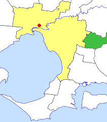 Location in Victoria | |||||||||||||||
| Population | 38,100 (1992)[1] | ||||||||||||||
| • Density | 198.79/km2 (514.9/sq mi) | ||||||||||||||
| Established | 1889 | ||||||||||||||
| Area | 191.66 km2 (74.0 sq mi) | ||||||||||||||
| Council seat | Upwey | ||||||||||||||
| Region | Outer Eastern Melbourne | ||||||||||||||
| County | Evelyn, Mornington | ||||||||||||||
|
| |||||||||||||||
| |||||||||||||||
The Shire of Sherbrooke was a local government area about 40 kilometres (25 mi) east of Melbourne, the state capital of Victoria, Australia. The shire covered an area of 191.66 square kilometres (74.0 sq mi), and existed from 1963 until 1994. Its largest population centre was the town of Belgrave.
History
Sherbrooke was originally the northwestern part of the Berwick Road District, which was incorporated on 24 October 1862 and became a shire on 12 May 1868. On 23 May 1889, the Scoresby Riding of the shire was severed, and incorporated as the Shire of Fern Tree Gully. With increasing urbanisation in suburbs closer to Melbourne, Fern Tree Gully in turn was splintered on 9 October 1963, to form the City of Knox and the Shire of Sherbrooke, which was named on 23 December 1964.[2]
On 15 December 1994, the Shire of Sherbrooke was abolished, and, along with the Shires of Lillydale, Healesville and Upper Yarra, was merged into the newly created Shire of Yarra Ranges. The districts around Emerald merged with the neighbouring Shire of Pakenham, into the newly created Shire of Cardinia, while Upper Ferntree Gully and Lysterfield were transferred to the City of Knox.[3]
Council formerly met at the Shire Offices in Upwey. After the amalgamations, these offices became the Burrinja Cultural Centre.
Wards
The Shire of Sherbrooke was divided into four ridings, each of which elected three councillors:
- Centre Riding
- East Riding
- Emerald Riding
- South Riding
Suburbs and localities
|
|
Population
| Year | Population |
|---|---|
| 1911 | 3,613 |
| 1933 | 9,171 |
| 1954 | 25,446 |
| 1958 | 30,360* |
| 1961 | 37,587+ |
| 1966 | 17,651+ |
| 1971 | 20,484 |
| 1976 | 25,584 |
| 1981 | 29,935 |
| 1986 | 34,766 |
| 1991 | 36,554 |
* Estimate in the 1958 Victorian Year Book.
+ Knox severed in 1963 - Sherbrooke population in 1961 was 16,306, and combined population for 1966 is 65,242.
References
- ↑ Australian Bureau of Statistics, Victoria Office (1994). Victorian Year Book. p. 49. ISSN 0067-1223.
- ↑ Victorian Municipal Directory. Brunswick: Arnall & Jackson. 1992. pp. 805–806, 832–833. Accessed at State Library of Victoria, La Trobe Reading Room.
- ↑ Australian Bureau of Statistics (1 August 1995). Victorian local government amalgamations 1994-1995: Changes to the Australian Standard Geographical Classification (PDF). Commonwealth of Australia. p. 23. ISBN 0-642-23117-6. Retrieved 2007-12-16.