Shire of Lillydale
| Shire of Lillydale Victoria | |||||||||||||||
|---|---|---|---|---|---|---|---|---|---|---|---|---|---|---|---|
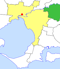 Location in Victoria | |||||||||||||||
| Population | 83,400 (1992)[1] | ||||||||||||||
| • Density | 209.82/km2 (543.4/sq mi) | ||||||||||||||
| Established | 1856 | ||||||||||||||
| Area | 397.49 km2 (153.5 sq mi) | ||||||||||||||
| Council seat | Lilydale | ||||||||||||||
| Region | E/NE Melbourne | ||||||||||||||
| County | Evelyn, Mornington | ||||||||||||||
|
| |||||||||||||||
| |||||||||||||||
The Shire of Lillydale (note spelling difference from the suburb of Lilydale) was a local government area about 40 kilometres (25 mi) northeast of Melbourne, the state capital of Victoria, Australia. The shire covered an area of 397.49 square kilometres (153.5 sq mi), and existed from 1856 until 1994.
History
The Lillydale Road District was first created on 19 September 1856, and became a shire on 16 February 1872. It lost its southwestern sections, when the Borough of Ringwood (22 October 1924) and the Shire of Croydon (24 May 1961) severed from the shire and incorporated separately.[2]
On 15 December 1994, the Shire of Lillydale was abolished, and, along with the Shires of Healesville and Upper Yarra and parts of the Shire of Sherbrooke, was merged into the newly created Shire of Yarra Ranges.[3]
Council formerly met at the Shire Offices in Lilydale.
The term "Labor Omnia Vincit", on the former Shire of Lillydale logo, is Latin for "Work conquers all".
Wards
The Shire of Lillydale was divided into four ridings on 31 May 1988, each of which elected three councillors:
- North Riding
- East Riding
- South Riding
- West Riding
Suburbs and localities
- Chirnside Park
- Coldstream
- Gruyere
- Kalorama
- Kilsyth (shared with the City of Croydon)
- Kilsyth South
- Lilydale
- Monbulk (shared with the Shire of Sherbrooke)
- Montrose
- Mooroolbark
- Mount Dandenong
- Mount Evelyn
- Olinda (shared with the Shire of Sherbrooke)
- Seville
- Silvan
- Wandin East
- Wandin North
- Warrandyte South (shared with the Doncaster & Templestowe)
- Wonga Park
- Yering
Population
| Year | Population |
|---|---|
| 1911 | 6,329 |
| 1947 | 13,809 |
| 1954 | 21,107 |
| 1958 | 26,990* |
| 1961 | 18,284+ |
| 1966 | 24,467 |
| 1971 | 36,162 |
| 1976 | 50,858 |
| 1981 | 62,077 |
| 1986 | 71,564 |
| 1991 | 78,475 |
* Estimate in the 1958 Victorian Year Book.
+ Croydon severed in 1961 - combined population for 1961 is 33,978.
References
- ↑ Australian Bureau of Statistics, Victoria Office (1994). Victorian Year Book. p. 49. ISSN 0067-1223.
- ↑ Victorian Municipal Directory. Brunswick: Arnall & Jackson. 1992. pp. 740–741. Accessed at State Library of Victoria, La Trobe Reading Room.
- ↑ Australian Bureau of Statistics (1 August 1995). Victorian local government amalgamations 1994-1995: Changes to the Australian Standard Geographical Classification (PDF). Commonwealth of Australia. p. 23. ISBN 0-642-23117-6. Retrieved 2007-12-16.