City of Croydon
| City of Croydon Victoria | |||||||||||||||
|---|---|---|---|---|---|---|---|---|---|---|---|---|---|---|---|
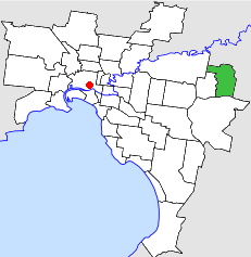 Location in Melbourne | |||||||||||||||
| Population | 48,900 (1992)[1] | ||||||||||||||
| • Density | 1,424.8/km2 (3,690/sq mi) | ||||||||||||||
| Established | 1961 | ||||||||||||||
| Area | 34.32 km2 (13.3 sq mi) | ||||||||||||||
| Council seat | Croydon | ||||||||||||||
| Region | Melbourne | ||||||||||||||
| County | Evelyn, Mornington | ||||||||||||||
| |||||||||||||||
The City of Croydon was a local government area located about 30 kilometres (19 mi) east of Melbourne, the state capital of Victoria, Australia. The city covered an area of 34.32 square kilometres (13.25 sq mi), and existed from 1961 until 1994.
History
Croydon was originally part of the Shire of Lillydale, which was incorporated as a district on 19 September 1856, and as a shire in 1872. Croydon itself became the centre of a severance movement, and was incorporated as a shire on 24 May 1961. After much local debate, it was proclaimed as a city on 22 May 1971.[2][3]
On 15 December 1994, the City of Croydon was abolished, and, along with the City of Ringwood, was merged into the newly created City of Maroondah.[4]
Council meetings were held at the Municipal Offices, on Civic Drive, off Mount Dandenong Road, Croydon. It presently serves as a service centre and library for the City of Maroondah.
Wards
The City of Croydon was subdivided into three wards, each electing three councillors:[2]
- North Ward
- Centre Ward
- South Ward
Suburbs
- Bayswater (shared with the City of Knox)
- Bayswater North
- Croydon
- Croydon Hills
- Croydon North
- Croydon South
- Kilsyth (shared with the Shire of Lillydale)
- Warranwood
Population
| Year | Population |
|---|---|
| 1961 | 15,694 |
| 1966 | 21,757 |
| 1971 | 28,708 |
| 1976 | 33,474 |
| 1981 | 36,210 |
| 1986 | 40,096 |
| 1991 | 45,807 |
* Estimate in the 1958 Victorian Year Book.
References
- ↑ Australian Bureau of Statistics, Victoria Office (1994). Victorian Year Book. p. 49. ISSN 0067-1223.
- 1 2 Victorian Municipal Directory. Brunswick: Arnall & Jackson. 1992. pp. 354–355, 740–741. Accessed at State Library of Victoria, La Trobe Reading Room.
- ↑ Monash University (1999). "Australian Places - Croydon". Archived from the original on 2003-04-24. Retrieved 2008-01-04.
- ↑ Australian Bureau of Statistics (1 August 1995). Victorian local government amalgamations 1994-1995: Changes to the Australian Standard Geographical Classification (PDF). Commonwealth of Australia. p. 9. ISBN 0-642-23117-6. Retrieved 2007-12-16.