City of Dandenong
| City of Dandenong Victoria | |||||||||||||||
|---|---|---|---|---|---|---|---|---|---|---|---|---|---|---|---|
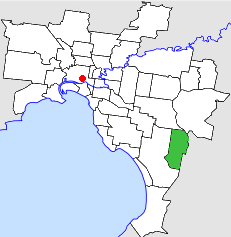 Location in Melbourne | |||||||||||||||
| Population | 59,000 (1992)[1] | ||||||||||||||
| • Density | 1,627/km2 (4,210/sq mi) | ||||||||||||||
| Established | 1955 | ||||||||||||||
| Area | 36.26 km2 (14.0 sq mi) | ||||||||||||||
| Council seat | Dandenong | ||||||||||||||
| Region | Melbourne | ||||||||||||||
| County | Mornington | ||||||||||||||
 | |||||||||||||||
The City of Dandenong was a local government area about 35 kilometres (22 mi) southeast of Melbourne, the state capital of Victoria, Australia. The city covered an area of 36.26 square kilometres (14.00 sq mi), and existed from 1857 until 1994.
History
Dandenong was part of the Shire of Dandenong, which was first incorporated in 1857 as a road district, and becoming a shire in 1873. On 31 May 1955, the new Shire of Dandenong was separately incorporated, while the original Shire of Dandenong was renamed Springvale and Noble Park. On 14 May 1959, Dandenong was proclaimed a city.[2]
On 15 December 1994, the City of Dandenong was abolished, and, along with parts of the Cities of Berwick, Cranbourne and Springvale, was merged into the newly created City of Greater Dandenong.[3]
Council meetings were held at the Town Hall, at Lonsdale Street and Walker Street, Dandenong, but most city business was conducted at the city offices in Clow Street, two blocks away. Both locations are still used by the City of Greater Dandenong for their original purpose.
Wards
The City of Dandenong was subdivided into four wards, each electing three councillors:[2]
- North West Ward
- North East Ward
- Centre Ward
- South West Ward
Suburbs
- Dandenong
- Dandenong North
- Dandenong South (shared with the City of Cranbourne)
- Keysborough (shared with the City of Springvale)
- Noble Park (shared with the City of Springvale)
- Noble Park North (shared with the City of Springvale)
Population
| Year | Population |
|---|---|
| 1955 | 27,748 |
| 1961 | 24,909 |
| 1966 | 31,659 |
| 1971 | 40,883 |
| 1976 | 48,444 |
| 1981 | 54,962 |
| 1986 | 56,461 |
| 1991 | 57,275 |
* Estimate in the 1958 Victorian Year Book.
References
- ↑ Australian Bureau of Statistics, Victoria Office (1994). Victorian Year Book. p. 48. ISSN 0067-1223.
- 1 2 Victorian Municipal Directory. Brunswick: Arnall & Jackson. 1992. pp. 356–357, 489–490. Accessed at State Library of Victoria, La Trobe Reading Room.
- ↑ Australian Bureau of Statistics (1 August 1995). Victorian local government amalgamations 1994-1995: Changes to the Australian Standard Geographical Classification (PDF). Commonwealth of Australia. p. 6. ISBN 0-642-23117-6. Retrieved 2007-12-16.