Shire of Eltham
| Shire of Eltham Victoria | |||||||||||||||
|---|---|---|---|---|---|---|---|---|---|---|---|---|---|---|---|
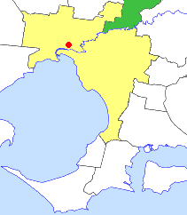 Location in outer Melbourne | |||||||||||||||
| Population | 44,800 (1992)[1] | ||||||||||||||
| • Density | 161.66/km2 (418.7/sq mi) | ||||||||||||||
| Established | 1856 | ||||||||||||||
| Area | 277.13 km2 (107.0 sq mi) | ||||||||||||||
| Council seat | Eltham | ||||||||||||||
| Region | NE Melbourne | ||||||||||||||
| County | Evelyn | ||||||||||||||
|
| |||||||||||||||
| |||||||||||||||
The Shire of Eltham was a local government area about 25 kilometres (16 mi) northeast of Melbourne, the state capital of Victoria, Australia. The shire covered an area of 277.13 square kilometres (107.0 sq mi), and existed from 1856 until 1994.
History
Eltham was first incorporated as a road district on 26 September 1856, and became a shire on 6 April 1871. In 1912, it lost some of its area to the Shire of Healesville.
On 18 June 1958, it lost its 218 km2 (84.2 sq mi) East Riding to the Shire of Healesville. This area comprised Yarra Glen, Dixons Creek and parts of Christmas Hills.[2] It also lost part of its North Riding, near Kinglake, to the Shire of Yea, on 1 October 1972.[3]
On 15 December 1994, the Shire of Eltham was abolished, and, along with parts of the Shire of Diamond Valley, was merged into the newly created Shire of Nillumbik. The Kinglake district was transferred to the Shire of Murrindindi, while Montmorency and Lower Plenty, in the shire's far southwest, were transferred to the City of Banyule.[4]
Wards
The Shire of Eltham was divided into three ridings on 16 March 1955, each of which elected three councillors:
- Central Riding
- North Riding
- West Riding
Suburbs and localities
- Briar Hill (shared with the Shire of Diamond Valley)
- Christmas Hills (shared with the Shire of Healesville)
- Cottles Bridge
- Eltham
- Greensborough (shared with the Shire of Diamond Valley)
- Hurstbridge (shared with the City of Whittlesea and the Shire of Diamond Valley)
- Kangaroo Ground
- Kinglake (shared with the Shire of Yea)
- Lower Plenty
- Montmorency
- Panton Hill
- Research
- Smiths Gully
- St Andrews
- Strathewen
- Warrandyte North
- Watsons Creek
- Wattle Glen (shared with the Shire of Diamond Valley)
Population
| Year | Population |
|---|---|
| 1911 | 3,423 |
| 1947 | 7,028 |
| 1954 | 11,441 |
| 1958 | 14,660* |
| 1961 | 16,575 |
| 1966 | 20,213 |
| 1971 | 23,712 |
| 1976 | 28,631 |
| 1981 | 34,648 |
| 1986 | 39,784 |
| 1991 | 42,670 |
* Estimate in 1958 Victorian Year Book.
See Also
Victorian Places: Eltham and Eltham Shire
OzSportsHistory: World War One In Memoriam Rolls Shire of Eltham
References
- ↑ Australian Bureau of Statistics, Victoria Office (1994). Victorian Year Book. p. 49. ISSN 0067-1223.
- ↑ Monash University (1999). "Australian Places - Eltham". Archived from the original on August 21, 2006. Retrieved 2008-01-05.
- ↑ Victorian Municipal Directory. Brunswick: Arnall & Jackson. 1992. pp. 666–667. Accessed at State Library of Victoria, La Trobe Reading Room.
- ↑ Australian Bureau of Statistics (1 August 1995). Victorian local government amalgamations 1994-1995: Changes to the Australian Standard Geographical Classification (PDF). Commonwealth of Australia. p. 4,10. ISBN 0-642-23117-6. Retrieved 2007-12-16.