Panton Hill, Victoria
| Panton Hill Melbourne, Victoria | |||||||||||||||
|---|---|---|---|---|---|---|---|---|---|---|---|---|---|---|---|
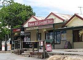 Panton Hill general store | |||||||||||||||
| Population | 1,062 (2016)[1] | ||||||||||||||
| Postcode(s) | 3759 | ||||||||||||||
| Elevation | 154 m (505 ft) | ||||||||||||||
| Location |
| ||||||||||||||
| LGA(s) | Shire of Nillumbik | ||||||||||||||
| State electorate(s) | |||||||||||||||
| Federal Division(s) | McEwen | ||||||||||||||
| |||||||||||||||
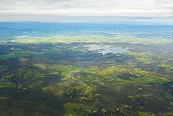
Panton Hill is a town in Victoria, Australia, 32 km north-east of Melbourne's Central Business District. Its local government area is the Shire of Nillumbik. At the 2016 Census, Panton Hill had a population of 1,062.
History
Originally called Kingstown, the area experienced population growth in the mid-1850s during the Victorian gold rush when prospectors mined the hills around the town known as the Caledonia Goldfields.
It was named after Joseph Anderson Panton, who was the magistrate at Heidelberg and spent much of his spare time mapping the Yarra Valley.
Panton Hill Post Office opened on 1 October 1875.[2]
The Panton Hill Primary School, number 1134, was originally a two (2) room building with the Headmasters residence beside it.
Today
The town has a hotel. General Store/Post Office and a football team called the Panton Hill Redbacks, competing in the Northern Football League and a cricket club in the Diamond Valley Cricket Association, with 4 senior teams and 4 junior teams.[3] It is also home to a small church, St. Matthews Anglican Church,([4]) and several wineries including Panton Hill Winery.
Panton Hill Primary School has an enrolment of approximately 150. The nearest high schools are Diamond Valley Secondary College and Eltham College of Education. Panton Hill also has a volunteer Country Fire Brigade that services Panton Hill and the surrounding areas. A park in the centre of town has been dedicated to the memory of 5 of Panton Hill's firefighters who perished on Ash Wednesday. Panton Hill Primary School's houses are named after these firefighters.
See also
- Shire of Eltham - Panton Hill was previously within this former local government area.
References
- ↑ Australian Bureau of Statistics (27 June 2017). "Panton Hill (State Suburb)". 2016 Census QuickStats. Retrieved 2017-07-04.

- ↑ Premier Postal History, Post Office List, retrieved 2008-04-11
- ↑ Full Points Footy, Northern Football League, retrieved 2009-04-15
- ↑ http://www.stmatthewspantonhill.org.au/
External links
| Wikimedia Commons has media related to Panton Hill, Victoria. |