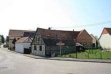
Scheibenhard
| Scheibenhard | ||
|---|---|---|
| Commune | ||
| ||
 Scheibenhard Location within Grand Est region  Scheibenhard | ||
| Coordinates: 48°58′47″N 8°08′16″E / 48.9797°N 8.1378°ECoordinates: 48°58′47″N 8°08′16″E / 48.9797°N 8.1378°E | ||
| Country | France | |
| Region | Grand Est | |
| Department | Bas-Rhin | |
| Arrondissement | Haguenau-Wissembourg | |
| Canton | Wissembourg | |
| Government | ||
| • Mayor (2001–2008) | Francis Joerger | |
| Area1 | 4.62 km2 (1.78 sq mi) | |
| Population (2006)2 | 845 | |
| • Density | 180/km2 (470/sq mi) | |
| Time zone | UTC+1 (CET) | |
| • Summer (DST) | UTC+2 (CEST) | |
| INSEE/Postal code | 67443 /67630 | |
| Elevation | 115–178 m (377–584 ft) | |
|
1 French Land Register data, which excludes lakes, ponds, glaciers > 1 km2 (0.386 sq mi or 247 acres) and river estuaries. 2 Population without double counting: residents of multiple communes (e.g., students and military personnel) only counted once. | ||
.svg.png)
Scheibenhard
Scheibenhard is a commune in the Bas-Rhin department in Grand Est in north-eastern France.
It lies on the German border, continuous with the German village of Scheibenhardt, separated only by a small creek, the Lauter.[1]
This creek became the border due to the Vienna Congress of 1815, but from 1870 to 1918 and 1940 till 1945 both sides were annexed by the German Empire/Nazi-Germany.
The village is situated near the easternmost corner of the French hexagon.
See also
References
- ↑ Scheibenhard in Quid encyclopedia Archived 2009-07-21 at the Wayback Machine.
External links
| Wikimedia Commons has media related to Scheibenhard. |
This article is issued from
Wikipedia.
The text is licensed under Creative Commons - Attribution - Sharealike.
Additional terms may apply for the media files.