Rountzenheim
| Rountzenheim Runzenem | ||
|---|---|---|
| Commune | ||
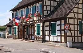 Mairie | ||
| ||
 Rountzenheim Location within Grand Est region  Rountzenheim | ||
| Coordinates: 48°49′11″N 8°00′25″E / 48.8197°N 8.0069°ECoordinates: 48°49′11″N 8°00′25″E / 48.8197°N 8.0069°E | ||
| Country | France | |
| Region | Grand Est | |
| Department | Bas-Rhin | |
| Arrondissement | Haguenau-Wissembourg | |
| Canton | Bischwiller | |
| Government | ||
| • Mayor (2001–2008) | Jean-Jacques Heintz | |
| Area1 | 6.67 km2 (2.58 sq mi) | |
| Population (2006)2 | 1,018 | |
| • Density | 150/km2 (400/sq mi) | |
| Time zone | UTC+1 (CET) | |
| • Summer (DST) | UTC+2 (CEST) | |
| INSEE/Postal code | 67418 /67480 | |
| Elevation | 116–121 m (381–397 ft) | |
|
1 French Land Register data, which excludes lakes, ponds, glaciers > 1 km2 (0.386 sq mi or 247 acres) and river estuaries. 2 Population without double counting: residents of multiple communes (e.g., students and military personnel) only counted once. | ||
.svg.png)
Rountzenheim (German: Runzenheim) is a commune in the Bas-Rhin department in Grand Est in north-eastern France.
See also
References
| Wikimedia Commons has media related to Rountzenheim. |
This article is issued from
Wikipedia.
The text is licensed under Creative Commons - Attribution - Sharealike.
Additional terms may apply for the media files.