Marckolsheim
| Marckolsheim Màrkelse | ||
|---|---|---|
| Commune | ||
 Barge in the lock beside the power station | ||
| ||
 Marckolsheim Location within Grand Est region  Marckolsheim | ||
| Coordinates: 48°10′N 7°32′E / 48.16°N 7.54°ECoordinates: 48°10′N 7°32′E / 48.16°N 7.54°E | ||
| Country | France | |
| Region | Grand Est | |
| Department | Bas-Rhin | |
| Arrondissement | Sélestat-Erstein | |
| Canton | Sélestat | |
| Intercommunality | Marckolsheim et environs | |
| Government | ||
| • Mayor (2008–2014) | Frédéric Pfliegersdoerffer | |
| Area1 | 33.36 km2 (12.88 sq mi) | |
| Population (2006)2 | 4,186 | |
| • Density | 130/km2 (320/sq mi) | |
| Time zone | UTC+1 (CET) | |
| • Summer (DST) | UTC+2 (CEST) | |
| INSEE/Postal code | 67281 /67390 | |
| Elevation | 170–184 m (558–604 ft) | |
|
1 French Land Register data, which excludes lakes, ponds, glaciers > 1 km2 (0.386 sq mi or 247 acres) and river estuaries. 2 Population without double counting: residents of multiple communes (e.g., students and military personnel) only counted once. | ||

Marckolsheim (German: Markolsheim) is a commune in the Bas-Rhin department in Alsace in north-eastern France.
On the eastern edge of the town the Casemate de Marckolsheim Sud, a Maginot Line fortification left over from the Second World War, has been converted into a small museum. Approximately 3 kilometres to the east the Rhine has been dammed and a hydro-electric power station installed.
Gallery
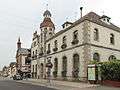 Rue du Maréchal Foch near the townhall
 Rue du Maréchal Foch near Rue Clemenceau
 The Rhine near Marckolsheim
See also
References
| Wikimedia Commons has media related to Marckolsheim. |
| Authority control |
|---|
This article is issued from
Wikipedia.
The text is licensed under Creative Commons - Attribution - Sharealike.
Additional terms may apply for the media files.