Saulgé
| Saulgé | |
|---|---|
| Commune | |
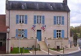 Town hall | |
 Saulgé Location within Nouvelle-Aquitaine region  Saulgé | |
| Coordinates: 46°22′43″N 0°52′35″E / 46.3786°N 0.8764°ECoordinates: 46°22′43″N 0°52′35″E / 46.3786°N 0.8764°E | |
| Country | France |
| Region | Nouvelle-Aquitaine |
| Department | Vienne |
| Arrondissement | Montmorillon |
| Canton | Montmorillon |
| Intercommunality | Montmorillonnais |
| Government | |
| • Mayor (2014–2020) | Jacques Larrant |
| Area1 | 62.31 km2 (24.06 sq mi) |
| Population (2016)2 | 1,039 |
| • Density | 17/km2 (43/sq mi) |
| Time zone | UTC+1 (CET) |
| • Summer (DST) | UTC+2 (CEST) |
| INSEE/Postal code | 86254 /86500 |
| Elevation |
87–202 m (285–663 ft) (avg. 100 m or 330 ft) |
|
1 French Land Register data, which excludes lakes, ponds, glaciers > 1 km2 (0.386 sq mi or 247 acres) and river estuaries. 2 Population without double counting: residents of multiple communes (e.g., students and military personnel) only counted once. | |
Saulgé is a commune in the Vienne department in the Nouvelle-Aquitaine region in central-western France. The village is located 50 km southeast of Poitiers and 80 km northwest of Limoges.
Population
| Historical population | ||
|---|---|---|
| Year | Pop. | ±% |
| 1793 | 1,012 | — |
| 1800 | 870 | −14.0% |
| 1806 | 953 | +9.5% |
| 1821 | 1,034 | +8.5% |
| 1831 | 1,050 | +1.5% |
| 1836 | 1,126 | +7.2% |
| 1841 | 1,105 | −1.9% |
| 1846 | 1,113 | +0.7% |
| 1851 | 1,257 | +12.9% |
| 1856 | 1,275 | +1.4% |
| 1861 | 1,264 | −0.9% |
| 1866 | 1,350 | +6.8% |
| 1872 | 1,367 | +1.3% |
| 1876 | 1,364 | −0.2% |
| 1881 | 1,463 | +7.3% |
| 1886 | 1,586 | +8.4% |
| 1891 | 1,552 | −2.1% |
| 1896 | 1,472 | −5.2% |
| 1901 | 1,430 | −2.9% |
| 1906 | 1,386 | −3.1% |
| 1911 | 1,388 | +0.1% |
| 1921 | 1,245 | −10.3% |
| 1926 | 1,236 | −0.7% |
| 1931 | 1,201 | −2.8% |
| 1936 | 1,191 | −0.8% |
| 1946 | 1,065 | −10.6% |
| 1954 | 995 | −6.6% |
| 1962 | 948 | −4.7% |
| 1968 | 868 | −8.4% |
| 1975 | 904 | +4.1% |
| 1982 | 950 | +5.1% |
| 1990 | 1,020 | +7.4% |
| 1999 | 980 | −3.9% |
| 2006 | 967 | −1.3% |
| 2007 | 965 | −0.2% |
| 2008 | 963 | −0.2% |
| 2009 | 968 | +0.5% |
| 2010 | 965 | −0.3% |
| 2011 | 978 | +1.3% |
| 2012 | 991 | +1.3% |
| 2013 | 1,004 | +1.3% |
| 2014 | 1,012 | +0.8% |
See also
References
| Wikimedia Commons has media related to Saulgé. |
This article is issued from
Wikipedia.
The text is licensed under Creative Commons - Attribution - Sharealike.
Additional terms may apply for the media files.