Gençay
| Gençay | ||
|---|---|---|
| Commune | ||
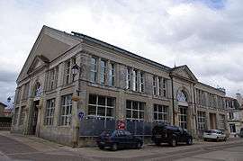 The town hall, in Gençay | ||
| ||
 Gençay Location within Nouvelle-Aquitaine region  Gençay | ||
| Coordinates: 46°22′24″N 0°24′21″E / 46.3733°N 0.4058°ECoordinates: 46°22′24″N 0°24′21″E / 46.3733°N 0.4058°E | ||
| Country | France | |
| Region | Nouvelle-Aquitaine | |
| Department | Vienne | |
| Arrondissement | Montmorillon | |
| Canton | Lussac-les-Châteaux | |
| Intercommunality | Pays Gencéen | |
| Government | ||
| • Mayor (2008–2014) | Jean Crespin | |
| Area1 | 4.74 km2 (1.83 sq mi) | |
| Population (2006)2 | 1,714 | |
| • Density | 360/km2 (940/sq mi) | |
| Time zone | UTC+1 (CET) | |
| • Summer (DST) | UTC+2 (CEST) | |
| INSEE/Postal code | 86103 /86160 | |
| Elevation |
105–138 m (344–453 ft) (avg. 125 m or 410 ft) | |
|
1 French Land Register data, which excludes lakes, ponds, glaciers > 1 km2 (0.386 sq mi or 247 acres) and river estuaries. 2 Population without double counting: residents of multiple communes (e.g., students and military personnel) only counted once. | ||
.svg.png)
Gençay is a commune in the Vienne department in the Nouvelle-Aquitaine region in western France. The inhabitants are called Gencéens.
Geography
The village lies on the left bank of the Clouère, which forms the commune's northern border.
Twin towns
See also
References
External links
| Wikimedia Commons has media related to Gençay. |
This article is issued from
Wikipedia.
The text is licensed under Creative Commons - Attribution - Sharealike.
Additional terms may apply for the media files.