Chatain
| Chatain | |
|---|---|
| Commune | |
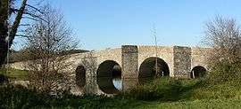 Bridge over the Charente | |
 Chatain Location within Nouvelle-Aquitaine region  Chatain | |
| Coordinates: 46°04′28″N 0°25′58″E / 46.0744°N 0.4328°ECoordinates: 46°04′28″N 0°25′58″E / 46.0744°N 0.4328°E | |
| Country | France |
| Region | Nouvelle-Aquitaine |
| Department | Vienne |
| Arrondissement | Montmorillon |
| Canton | Civray |
| Intercommunality | Pays Charlois |
| Government | |
| • Mayor (2008–2014) | Philippe Grollier |
| Area1 | 22.05 km2 (8.51 sq mi) |
| Population (2006)2 | 338 |
| • Density | 15/km2 (40/sq mi) |
| Time zone | UTC+1 (CET) |
| • Summer (DST) | UTC+2 (CEST) |
| INSEE/Postal code | 86063 /86250 |
| Elevation | 125–193 m (410–633 ft) |
|
1 French Land Register data, which excludes lakes, ponds, glaciers > 1 km2 (0.386 sq mi or 247 acres) and river estuaries. 2 Population without double counting: residents of multiple communes (e.g., students and military personnel) only counted once. | |
Chatain is a commune in the Vienne department in the Nouvelle-Aquitaine region in western France.
See also
References
| Wikimedia Commons has media related to Chatain. |
This article is issued from
Wikipedia.
The text is licensed under Creative Commons - Attribution - Sharealike.
Additional terms may apply for the media files.