Mazerolles, Vienne
| Mazerolles | |
|---|---|
| Commune | |
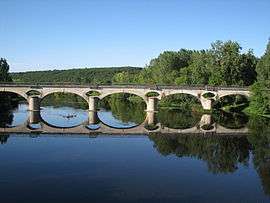 The railway bridge over the Vienne river, in Mazerolles | |
 Mazerolles Location within Nouvelle-Aquitaine region  Mazerolles | |
| Coordinates: 46°24′20″N 0°41′05″E / 46.4056°N 0.6847°ECoordinates: 46°24′20″N 0°41′05″E / 46.4056°N 0.6847°E | |
| Country | France |
| Region | Nouvelle-Aquitaine |
| Department | Vienne |
| Arrondissement | Montmorillon |
| Canton | Lussac-les-Châteaux |
| Intercommunality | Lussacois |
| Government | |
| • Mayor (2008–2014) | Jackie Pérault |
| Area1 | 21.25 km2 (8.20 sq mi) |
| Population (2006)2 | 806 |
| • Density | 38/km2 (98/sq mi) |
| Time zone | UTC+1 (CET) |
| • Summer (DST) | UTC+2 (CEST) |
| INSEE/Postal code | 86153 /86320 |
| Elevation |
70–151 m (230–495 ft) (avg. 80 m or 260 ft) |
|
1 French Land Register data, which excludes lakes, ponds, glaciers > 1 km2 (0.386 sq mi or 247 acres) and river estuaries. 2 Population without double counting: residents of multiple communes (e.g., students and military personnel) only counted once. | |
Mazerolles is a commune in the Vienne department in the Nouvelle-Aquitaine region in western France.
History
Along the border of the river Vienne, a cenotaph of constable John Chandos was erected shortly after his death by the English authorities to commemorate the spot where he was killed by the spear of french knight Guillaume Boitel. The cenotaph is still maintained and visible in a garden along the street Jean Chandos at a place called "Les Aubeniaux" . At the end of the XIXth century, the local society of history moved it of some yards from the border of the Vienne because of the recurrent flood of this river.
See also
References
| Wikimedia Commons has media related to Mazerolles (Vienne). |
This article is issued from
Wikipedia.
The text is licensed under Creative Commons - Attribution - Sharealike.
Additional terms may apply for the media files.