San Mateo station
San Mateo | ||||||||||||||||||||
|---|---|---|---|---|---|---|---|---|---|---|---|---|---|---|---|---|---|---|---|---|
| Commuter rail | ||||||||||||||||||||
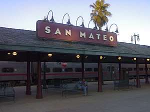 The southbound platform at San Mateo. | ||||||||||||||||||||
| Location |
385 First Avenue San Mateo, CA 94401 | |||||||||||||||||||
| Coordinates | 37°34′06″N 122°19′27″W / 37.5683°N 122.3241°WCoordinates: 37°34′06″N 122°19′27″W / 37.5683°N 122.3241°W | |||||||||||||||||||
| Owned by | Peninsula Corridor Joint Powers Board | |||||||||||||||||||
| Line(s) |
Caltrain | |||||||||||||||||||
| Platforms | 2 side platforms | |||||||||||||||||||
| Tracks | 2 | |||||||||||||||||||
| Connections | SamTrans: 250, 252, 295 | |||||||||||||||||||
| Construction | ||||||||||||||||||||
| Parking | Available | |||||||||||||||||||
| Bicycle facilities | Lockers available | |||||||||||||||||||
| Disabled access | Yes | |||||||||||||||||||
| Other information | ||||||||||||||||||||
| Fare zone | Fare Zone 2 | |||||||||||||||||||
| Traffic | ||||||||||||||||||||
| Passengers (2017) |
2103 per weekday[1] | |||||||||||||||||||
| Services | ||||||||||||||||||||
| ||||||||||||||||||||
San Mateo is the northernmost of the three Caltrain stations in San Mateo, California. It is in downtown San Mateo.
Platforms and tracks
| Northbound | ■ Local service | toward San Francisco (Burlingame) |
| ■ Limited-stop service | toward San Francisco (Burlingame) | |
| ■ Baby Bullet, Peak, Pattern B | toward San Francisco (Millbrae) | |
| Southbound | ■ Local service | toward Gilroy (Hayward Park) |
| ■ Limited-stop service | toward Tamien, Gilroy during peak hours (Hayward Park) | |
| ■ Baby Bullet, Peak, Pattern B | toward Tamien (Redwood City) |
History
The first station serving downtown San Mateo was located between 2nd and 3rd at Railroad.[2] On June 15, 1883, a "disastrous fire" destroyed San Mateo's Central block, located across the street from the station.[3]:233 Antoine Borel donated a lot in the block burned clear by the fire which become the site of the first public library in San Mateo;[4] that building, named "Library Hall", was later converted to serve as City Hall.[5] The depot and Library Hall both sustained damage in the 1906 San Francisco earthquake.[6][7] Library Hall and the old depot were torn down in 1976, and a parking structure was erected on the old site.[8] Today, the site holds a 12-screen cinema, and a mural in the courtyard pays homage to Library Hall.[9]
The second station was located one block south of the first, between 3rd and 4th. It was replaced in 2000, following the completion of an $11 million project to relocate the station. Trains stopping at the second station would block automobile traffic on major downtown streets, since the center boarding platform was between 3rd and 4th.[10]
The third and current station lies completely north of 1st, and there are no at-grade crossings for automotive traffic in the station platform area. A large mural entitled "Mr. Ralston Racing the Train", showing a race between a stagecoach and the train, was painted in 2000 by Nick Motley and "Little" Bobby Duncan under a commission from Eric Pennington on the exterior of an auto body shop at 1st and Railroad, near the south end of the northbound platform;[9] a new mural entitled "Good Life" replaced it in 2016.[11] "Good Life" was painted by Brian Barneclo, who also created one of the longest murals in San Francisco near the 4th and King station.[12][13]
Bridges
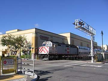
Just north of the station are four steel rail bridges crossing (from south to north) Tilton, Monte Diablo, E. Santa Inez, and E. Poplar avenues, the earliest grade separations on the Southern Pacific Coast Line (between San Francisco and Gilroy) and among the earliest grade separations in the entire state.[14]:14 The four rail bridges were built by the American Bridge Company for Southern Pacific in 1903, and sacrificial steel beams were added in 2006 to prevent damage from vehicle strikes. The bridges had low vertical clearances as they predate the prevalence of automobile transport:
- Tilton: 8 ft 6 in (2.59 m)[14]:3
- Monte Diablo: 11 ft 1 in (3.38 m)[15]:2
- Santa Inez: 12 ft 3 in (3.73 m)[16]:2
- Poplar: 13 ft (4.0 m)[17]:2
Because the original rail bridges did not meet modern seismic safety standards, Caltrain and the City of San Mateo replaced the bridges during a project completed in October 2016.[18] Planning for the bridge replacement started over a decade earlier.[19] Although increasing the vertical clearance below the tracks was studied[20]:1 and was meant to be accomplished by raising tracks up to 4 ft 6 in (1.37 m) over their current elevation,[21] an exemption was granted in 2014 to allow the low clearances at Monte Diablo and Tilton to continue, as raising the clearances at those bridges would also raise the track profile through the San Mateo station, requiring the platforms to be rebuilt.[22] Lowering the roadways was not possible due to interference with subsurface utilities.[23] The underpass at Tilton remains at 8 ft 6 in (2.59 m) of vertical clearance, more than 3 feet (0.91 m) less than the famous 11 foot 8 Bridge in North Carolina.
Station amenities
- Police station
- Underground parking garage
- The Melting Pot (restaurant)
References
- ↑ Caltrain. "2017 Annual Count Key Findings Report" (PDF). Retrieved 2018-01-29.
- ↑ "President McKinley's Visit #3". Calisphere. San Mateo Public Library. 1901. Retrieved 8 March 2018.
- ↑ History of San Mateo County, California, including its geography, topography, geology, climatography, and description, together with an historical sketch of California; a record of the Mexican grants; the early history and settlement, compiled from the most authentic sources; some of the names of Spanish and American pioneers; legislative history; a record of its cities and towns; biographical sketches of representative men; etc., etc. San Francisco: B.F. Alley. 1883. Retrieved 8 March 2018.
- ↑ "History of the Library". San Mateo Public Library. Retrieved 8 March 2018.
- ↑ "Levy Brothers covered coach at the San Mateo train depot". Calisphere. San Mateo Public Library. Retrieved 8 March 2018.
- ↑ "1906 Earthquake Damage to Southern Pacific Railroad Equipment". Calisphere. San Mateo Public Library. April 1906. Retrieved 8 March 2018.
- ↑ "Library Hall roof damage due to 1906 earthquake". Calisphere. San Mateo Public Library. April 1906. Retrieved 8 March 2018.
- ↑ "Peninsula Commuter Rail History". BayRail Alliance. Retrieved 7 March 2018.
- 1 2 "Sculptures and Public Art Pieces in San Mateo". City arts of San Mateo. Retrieved 9 March 2018.
- ↑ Tillier, Clem (5 July 2009). "Focus on: San Mateo". Caltrain-HSR Compatibility Blog. Retrieved 7 March 2018.
- ↑ "Good Life 2017". Wescover. 2017. Retrieved 8 March 2018.
- ↑ Beale, Scott (30 July 2012). "The Systems Mural Project by Brian Barneclo, The Largest Mural in San Francisco Measures 600 Feet Long". Laughing Squid. Retrieved 8 March 2018.
- ↑ Vaziri, Aidin (2 September 2011). "Brian Barneclo painting 'Systems Mural Project'". San Francisco Chronicle. Retrieved 8 March 2018.
- 1 2 McMorris, Christopher; Miller, Chandra (June 2010). Tilton Avenue Underpass (Bridge No. 35C0087), HAER No. CA-2277 (PDF) (Report). Historic American Engineering Record, National Park Service, Pacific West Region. Retrieved 7 March 2018.
- ↑ McMorris, Christopher; Miller, Chandra (June 2010). Monte Diablo Avenue Underpass, HAER No. CA-2276 (PDF) (Report). Historic American Engineering Record, National Park Service, Pacific West Region. Retrieved 7 March 2018.
- ↑ McMorris, Christopher; Miller, Chandra (June 2010). Santa Inez Avenue Underpass (Bridge No. 35C0090), HAER No. CA-2275 (PDF) (Report). Historic American Engineering Record, National Park Service, Pacific West Region. Retrieved 7 March 2018.
- ↑ McMorris, Christopher; Miller, Chandra (June 2010). East Poplar Avenue Underpass (Bridge No. 35C0091), HAER No. CA-2274 (PDF) (Report). Historic American Engineering Record, National Park Service, Pacific West Region. Retrieved 7 March 2018.
- ↑ "San Mateo Bridges Replacement Project". Peninsula Corridor Joint Powers Board. Retrieved 7 March 2018.
- ↑ Choi, Yunmi (10 July 2003). "Rail bridge upgrade raises concerns". San Mateo Daily Journal. Retrieved 7 March 2018.
- ↑ Parsons (August 15, 2006). Final Noise and Vibration Study: Caltrain replacement or reconstruction of seven bridges (PDF) (Report). Peninsula Corridor Joint Powers Board. Retrieved 7 March 2018.
- ↑ "San Mateo Bridges Replacement Project" (PDF). Peninsula Corridor Joint Powers Board. October 2, 2014. Retrieved 7 March 2018.
- ↑ "Resolution SX-110, Granting authorization to deviate from the provisions of Section 12.1 of General Order 26-D requiring a minimum vertical clearance of 15 feet above the roadway at the grade-separated highway-rail crossings at Monte Diablo Avenue and Tilton Avenue in the City of San Mateo in San Mateo County".

- ↑ "San Mateo Bridges Replacement Project Public Meeting FAQs" (PDF). Peninsula Corridor Joint Powers Board. Retrieved 7 March 2018.
28. Did Caltrain assess the viability of lowering the roads rather than raising the rail bridges and berms?
a. Yes. There are two reasons why lowering the streets is not viable in this case. One there are gravity fed sewers just below grade level which would conflict with the lowering, and secondly: in order to lower the streets, private driveways would need to be purchased and lowered and in some cases this is not feasible due to the geometry.
External links

- Caltrain San Mateo station page
- "San Mateo Bridges Photos". Peninsula Corridor Joint Powers Board. 2006. Retrieved 7 March 2018.
- "Downtown Area Plan". City of San Mateo. February 2009. Retrieved 8 March 2018.
- Strickland, Michael (2 April 2017). "CalTrain Commmute to Super Evil Megacorp". Civic Center [blog]. Retrieved 8 March 2018.
| Stations |
| |
|---|---|---|
| Connecting services | ||
| Management | ||
| History | ||
| Projects |
| |
| Miscellaneous | ||
Category | ||