Rockridge station
Rockridge | |||||||||||
|---|---|---|---|---|---|---|---|---|---|---|---|
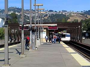 Eastbound train leaving Rockridge station in October 2017 | |||||||||||
| Location |
5660 College Avenue Oakland, California | ||||||||||
| Coordinates | 37°50′40″N 122°15′07″W / 37.844452°N 122.252083°WCoordinates: 37°50′40″N 122°15′07″W / 37.844452°N 122.252083°W | ||||||||||
| Owned by | Bay Area Rapid Transit | ||||||||||
| Platforms | 1 island platform | ||||||||||
| Tracks | 2 | ||||||||||
| Connections |
| ||||||||||
| Construction | |||||||||||
| Parking | 903 spaces | ||||||||||
| Bicycle facilities | racks, 72 lockers | ||||||||||
| Disabled access | Yes | ||||||||||
| History | |||||||||||
| Opened | May 21, 1973 | ||||||||||
| Traffic | |||||||||||
| Passengers (FY 2016) | 6,184 exits/day[1] | ||||||||||
| Services | |||||||||||
| |||||||||||
Rockridge is a Bay Area Rapid Transit station located in the Rockridge district of Oakland, California. Located in the center median of the elevated State Route 24 west of the Caldecott Tunnel, the station has a single island platform serving two tracks.
Service at Rockridge began on May 21, 1973, following the completion of the Berkeley Hills Tunnel.[2]
See also
References
- ↑ Bay Area Rapid Transit District. "Monthly Ridership Reports". Retrieved 6 February 2017.
- ↑ "BART Chronology January 1947 – March 2009" (PDF). San Francisco Bay Area Rapid Transit District. March 2009. Archived from the original (PDF) on October 13, 2013.
External links
![]()
| Current lines |
| ||||||||||||
|---|---|---|---|---|---|---|---|---|---|---|---|---|---|
| Stations |
| ||||||||||||
| Infrastructure | |||||||||||||
| History | |||||||||||||
| General Managers |
| ||||||||||||
| Connecting services |
| ||||||||||||
| Other | |||||||||||||
| Economy |  | ||
|---|---|---|---|
| Education |
| ||
| Government | |||
| History | |||
| Sports | |||
| Transportation |
| ||
| Other | |||
| Related | |||
| |||
This article is issued from
Wikipedia.
The text is licensed under Creative Commons - Attribution - Sharealike.
Additional terms may apply for the media files.