Samarinda
| Samarinda | ||
|---|---|---|
| City | ||
 From top, left to right: Grand Barumbay Resort, Official government building, Entrance of East Kalimantan main stadium, Lembuswana sculpture (Lembuswana is a legendary creature appearing in Kutai mythology of Samarinda), Building Archdiocese of Samarinda, Vihara Eka Dharma Manggala, and Samarinda Islamic Center Mosque. | ||
| ||
| Motto(s): Samarinda Kota Tepian | ||
| Anthem: "March of Kota Tepian" | ||
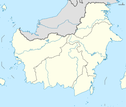
 Location within East Kalimantan | ||
 Samarinda Location in Kalimantan and Indonesia  Samarinda Samarinda (Indonesia) | ||
| Coordinates: 0°25′9.68″S 117°9′13.34″E / 0.4193556°S 117.1537056°ECoordinates: 0°25′9.68″S 117°9′13.34″E / 0.4193556°S 117.1537056°E | ||
| Country |
| |
| Province |
| |
| Founded | 1668 | |
| Government | ||
| • Mayor | Syaharie Jaang | |
| • President of the Regional Representative Council | Alphad Syarif | |
| Area | ||
| • Total | 718 km2 (277 sq mi) | |
| Elevation | 8 m (26 ft) | |
| Population | ||
| • Estimate (2014) | 842,691 | |
| • Rank | (19th) | |
| • Density | 1,174/km2 (3,040/sq mi) | |
| Demographics | ||
| • Religion[1] |
Islam 90.93% Christianity 5.25% Catholic 2.12% Buddhism 0.86% Hinduism 0.12% Confucianism 0.08% Others 0.01% | |
| Time zone | UTC+8 (CIT) | |
| • Summer (DST) | UTC+8 (not observed) | |
| Area code(s) | +62541 | |
| Date format | dd-mm-yyyy | |
| Drives on the | left | |

Samarinda is the capital of the Indonesian province of East Kalimantan on the island of Borneo. The city lies on the banks of the Mahakam River. It is the most populous city on the entire Borneo island, with an estimated population of 842,691,[2] up from 726,223 at the 2010 Census.[3] Although it is the capital of East Kalimantan, some government institutions such as the Police, Indonesian Army District VI Of Tanjung Pura, and Pelabuhan Indonesia (Port Transportation) are located on the island. Samarinda is known for its traditional food amplang, as well as the cloth sarung samarinda.[4] The city also has a bridge connecting its river banks, Mahakam Bridge. The city center is on one side and the other side is named Samarinda Seberang.
History
At the start of the Gowa War, the Dutch under Admiral Speelman's command attacked Makassar from the sea. Meanwhile, the Netherlands' local ally Arung Palaka led a ground attack. The Kingdom of Gowa was forced to surrender and Sultan Hasanuddin was made to sign the Treaty of Bongaja on 19 November 1667.[5]
The treaty did not quell all trouble for the Dutch however, since the Bugis from Gowa continued their struggle using guerilla tactics. Some Buginese moved to other islands close by such as Kalimantan. A few thousand people led by Lamohang Daeng Mangkona or Pua Ado I, moved to East Kalimantan, known then as Kutai, where they were welcomed by the local Sultan.
Samarinda was a small, sleepy town in 1942 with several small oil fields in the vicinity. It was occupied by the Japanese after the Dutch East Indies had fallen.[6]
In 1955, the Apostolic Vicariate of Samarinda was established in the city. In 1961, it was promoted as the Diocese of Samarinda. In 2003, the diocese was promoted as the. Metropolitan Archdiocese of Samarinda.[5]
Recent developments such as malls and housing complex have made Samarinda a little more livable than it was before.
Administration
Samarinda City is divided into six districts (Indonesian: kecamatan), tabulated below with their 2010 Census population:[3]
| Name | Population Census 2010 |
|---|---|
| Palaran | 49,079 |
| Samaranda Ilir | 120,936 |
| Samarinda Seberang | 114,183 |
| Sungai Kunjang | 114,044 |
| Samarinda Ulu | 126,651 |
| Samarinda Utara (North Samarinda) | 202,607 |
Etymology
The name Samarinda originates from the description of the way in which the Bugis houses were constructed. At that time houses were customarily built on a raft and generally had the same height. This provided important social symbolism of equality between residents; no person's house, and thus no person, was seen as higher or lower than another. They named the settlement 'Samarenda', meaning 'equal in height'. After hundreds of years of use the pronunciation of the name changed slightly and the city became known as Samarinda.[7]
Economy
Infrastructure
Samarinda Airport is one of Kaltim's busiest airports in terms of passenger and cargo movement, serving more than 126 thousand passengers and handling 241 tonnes of cargo in 2013.[8] 3 airlines operate at the airport and it is the primary hub of Kaltim Airlines.
The prominent coal loading port of Tanjung Bara (TBCT) lies about 160 kilometres to the north of Samarinda.[9]
Demographics
The territory's population in 2014 was 800,000, with an average annual growth rate of 6.7% over the previous 5 years. The majority of the people of Samarinda are of Native Indonesian and Chinese descent. There are also Americans, Canadians, Japanese and Koreans working in Samarinda. Life expectancy in Samarinda is 73.6 years as of 2014.
Religion
Samarinda's main religions are Islam, Buddhism and Confucianism. A Christian community of around 89,000 forms about 10.2% of the total population; Protestants form a larger number than Roman Catholics at a rate of 10:3. There are also Hindu communities.
References
Citations
- ↑ Data Sensus Penduduk 2010 - Badan Pusat Statistik Republik Indonesia <http://sp2010.bps.go.id/index.php/site/tabel?tid=321&wid=6400000000&lang=id>
- ↑ http://www.depkes.go.id/downloads/Penduduk%20Kab%20Kota%20Umur%20Tunggal%202014.pdf
- 1 2 Biro Pusat Statistik, Jakarta, 2011.
- ↑ "Perhatikan 4 Hal Ini Saat Berburu Oleh-oleh Khas Samarinda". JalanTikus.
- 1 2 Ars, Moh (1986). Sejarah Kota Samarinda. Jakarta: Ministry of Education and Culture.
- ↑ L, Klemen (1999–2000). "The conquest of Borneo Island, 1941-1942". Forgotten Campaign: The Dutch East Indies Campaign 1941-1942.
- ↑ Dahlan, Oemar (1978). Asal-Usul Nama Samarinda Sejak Zaman sebelum Kemerdekaan, Nama Ini Sudah Terkenal di Seluruh Indonesia. Jakarta: Ministry of Education and Culture.
- ↑ "BPS Samarinda". Samarinda Airport. Archived from the original on 16 October 2014. Retrieved 16 October 2014.
- ↑ Admiralty sailing directions - Indonesia (10th ed.). Taunton: UK Hydrographic office. 15 July 2015.
|access-date=requires|url=(help)
Sources
- L, Klemen (1999–2000). "Forgotten Campaign: The Dutch East Indies Campaign 1941-1942".
External links
- GovSamarinda Samarinda Government portal
| Wikimedia Commons has media related to Samarinda. |
Regencies and cities of East Kalimantan | ||
|---|---|---|
Capital: Samarinda | ||
| Regencies | ||
| Cities | ||
| 2,000,000 and more | |
|---|---|
| 1,000,000-1,999,999 | |
| 400,000-999,999 | |
| 200,000-399,999 | |
| Authority control |
|---|