Palu
| Palu | ||
|---|---|---|
| City | ||
 Palu Bay | ||
| ||
 Palu Location of Palu in Sulawesi  Palu Palu (Indonesia) | ||
| Coordinates: 0°53′42″S 119°51′34″E / 0.89500°S 119.85944°ECoordinates: 0°53′42″S 119°51′34″E / 0.89500°S 119.85944°E | ||
| Country |
| |
| Province |
| |
| Incorporated | 27 September 1978 | |
| City Status | 22 July 1994 | |
| Government | ||
| • Mayor | Hidayat | |
| • Vice Mayor | Sigit Purnomo Syamsuddin Said | |
| Area | ||
| • Total | 395.06 km2 (152.53 sq mi) | |
| Elevation | 118 m (387 ft) | |
| Population (2010) | ||
| • Total | 335,297 | |
| • Density | 850/km2 (2,200/sq mi) | |
| Time zone | UTC+8 (Indonesia Central Time) | |
| Area code | (+62) 451 | |
| Website |
www | |

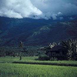
Palu is a chartered city on the Indonesian island of Sulawesi, 1,650 kilometres (1,030 miles) northeast of Jakarta, at the mouth of the Palu River. It is the capital of the province of Central Sulawesi, situated on a long, narrow bay. Because of its sheltered position between mountain ridges, the climate is unusually dry. At the 2010 census Palu had a population of around 336,300, not including those living in neighboring regencies.[1] On 28 September 2018, the city suffered a large number of casualties due to a tsunami, where more than 7,000 people lost their lives.[2]
Administration
The city was divided at 2010 into four districts (kecamatan), tabulated below with their 2010 Census population.[3]
| Name | Population Census 2010 |
|---|---|
| Palu Barat (West Palu) | 98,739 |
| Palu Selatan (South Palu) | 122,752 |
| Palu Timur (East Palu) | 75,967 |
| Palu Utara (North Palu) | 39,074 |
History


The town was part of the Dutch Empire until Indonesia won independence in 1945–49. The Dutch controleur's house survives as a testament of that era.
CIA air raids
In April 1958 during the Permesta rebellion in North Sulawesi, the USA supported and supplied the rebels. Pilots from a CIA Taiwan-based front organisation, Civil Air Transport, flying CIA B-26 Invader aircraft, repeatedly bombed and machine-gunned targets in and around Palu; destroying vehicles, buildings, a bridge and a ship.[4]
2005 earthquake
On 24 January 2005 at 04:10 (UTC+8), an earthquake with a magnitude of 6.2 occurred in the city. According to the local meteorological office, the epicenter of the earthquake was around 1.249° S, 119.922° E, some 16 kilometres (10 miles) southeast of Palu at the depth of 30 kilometres (19 miles) of Bora Village's hot spring, Biromaru sub-district, Donggala Regency. Panic ensued as most people sought refuge in the highlands for fear of a repeat disaster like the tsunami as occurred in Aceh. The earthquake killed one person, injured four others, and destroyed 177 buildings.[5][6]
2005 market bombing
On 31 December 2005 at about 07:35 (UTC +8) a bomb blast,[7] described as a nail bomb or similar,[8] detonated around 07:00 in a butcher's market mostly frequented by Christian Minahasa shopping for New Year's Eve celebrations, killing eight people and wounding another 53.[8][9][10]
2018 tsunami
On 28 September 2018, Palu was hit by a 5-metre-high tsunami shortly after a magnitude 7.5 earthquake occurred 80 km north of the city, causing a large number of casualties. Other cities were also struck by the tsunami.[11][12] As of 8 October, the death toll has jumped to 1,944 as reported by the Indonesian National Board for Disaster Management.[13]
Climate
| Climate data for Palu | |||||||||||||
|---|---|---|---|---|---|---|---|---|---|---|---|---|---|
| Month | Jan | Feb | Mar | Apr | May | Jun | Jul | Aug | Sep | Oct | Nov | Dec | Year |
| Record high °C (°F) | 38 (100) |
37 (99) |
37 (99) |
37 (99) |
35 (95) |
37 (99) |
37 (99) |
37 (99) |
38 (100) |
37 (99) |
37 (99) |
38 (100) |
38 (100) |
| Average high °C (°F) | 30 (86) |
30 (86) |
31 (88) |
31 (88) |
31 (88) |
31 (88) |
30 (86) |
31 (88) |
31 (88) |
31 (88) |
31 (88) |
30 (86) |
31 (88) |
| Daily mean °C (°F) | 27 (81) |
27 (81) |
27 (81) |
28 (82) |
28 (82) |
27 (81) |
27 (81) |
27 (81) |
27 (81) |
28 (82) |
28 (82) |
27 (81) |
27 (81) |
| Average low °C (°F) | 24 (75) |
24 (75) |
24 (75) |
25 (77) |
25 (77) |
24 (75) |
24 (75) |
24 (75) |
24 (75) |
25 (77) |
25 (77) |
25 (77) |
24 (75) |
| Record low °C (°F) | 22 (72) |
21 (70) |
18 (64) |
20 (68) |
21 (70) |
21 (70) |
21 (70) |
20 (68) |
20 (68) |
17 (63) |
21 (70) |
21 (70) |
17 (63) |
| Average precipitation mm (inches) | 101 (3.98) |
88 (3.46) |
90 (3.54) |
102 (4.02) |
130 (5.12) |
157 (6.18) |
158 (6.22) |
147 (5.79) |
164 (6.46) |
109 (4.29) |
110 (4.33) |
76 (2.99) |
1,274 (50.16) |
| Average precipitation days | 7 | 8 | 9 | 9 | 10 | 12 | 11 | 9 | 8 | 7 | 9 | 7 | 106 |
| Average relative humidity (%) | 75 | 76.5 | 75.5 | 76 | 75.5 | 76.5 | 77 | 74 | 74.5 | 73 | 73 | 74.5 | 75 |
| Source #1: weatherbase[14] | |||||||||||||
| Source #2: climate-data[15] | |||||||||||||
Transport
Palu is served by Mutiara Sis Al-Jufri Airport, which is located outside the city center.
Military
Palu is the site of an Indonesian Navy base, and the planned home of the Indonesian Navy's submarines.[16] A quay wall and environmental shelter covering the submarine berthing area were destroyed in the 2018 Sulawesi earthquake and tsunami.[16]
Sister cities
Notable people
- Longki Djanggola, governor of the province
Indonesia Open Paragliding Championship
Indonesia Open Paragliding Championship is one of the world championship series which it was the first Indonesia Open held in the region on 19–25 June 2011. 78 paragliders taking part in the championship from Indonesia, Japan, Malaysia, the Philippines, Russia, South Korea and Switzerland competed at Wayu village (the Matantimali hills, 800 masl) about 30 kilometres (19 miles) from Palu.[17]
References
- ↑ "HASIL SENSUS PENDUDUK 2010 SULAWESI TENGAH". Archived from the original on 18 February 2011. Retrieved 8 December 2010.
- ↑ ABS-CBN News (8 October 2018). "More bodies found as death toll from Indonesia quake nears 2000". Retrieved 8 October 2018.
- ↑ Biro Pusat Statistik, Jakarta, 2011.
- ↑ Conboy, Kenneth; Morrison, James (1999). Feet to the Fire CIA Covert Operations in Indonesia, 1957–1958. Annapolis: Naval Institute Press. pp. 101, 105, 116, 118, 121. ISBN 1-55750-193-9.
- ↑ "Indonesian quake causes panic". BBC News. 24 January 2005.
- ↑ "EO Natural Hazards: Earthquake in Sulawesi".
- ↑ "Indonesia bomb leaves eight dead". BBC News. 31 December 2005.
- 1 2 "Bombing kills eight at Indonesian market". USA Today. Associated Press. 31 January 2005. Retrieved 28 July 2011.
- ↑ "At least eight killed in Indonesia market blast". CTV.ca News. 31 December 2005. Retrieved 28 July 2011.
- ↑ "Indonesian police detain man after market bombing". ABC Australia. Reuters. 1 January 2006. Retrieved 28 July 2011.
- ↑ (in English) "Tsunami hits Indonesia's Palu after strong earthquake". BBC News. 28 September 2018.
- ↑ "BREAKING: Video shows tsunami hitting Palu after 7.7-magnitude quake". The Jakarta Post. 28 September 2018.
- ↑ ABS-CBN News (8 October 2018). "More bodies found as death toll from Indonesia quake nears 2000". Retrieved 8 October 2018.
- ↑ "PALU, INDONESIA". weatherbase.com. Retrieved 15 July 2017.
- ↑ "CLIMATE TABLE // HISTORICAL WEATHER DATA". climate-data.org. Retrieved 15 July 2017.
- 1 2 "Indonesia Submarine Quay and Pier Damaged During Tsunami". bellingcat. October 5, 2018. Retrieved October 8, 2018.
- ↑ Maruli, Aditia (18 June 2011). "Indonesia hosts paragliding open championship in Palu". Antara News.
External links
| Wikimedia Commons has media related to Palu. |
- Official site (in Indonesian)
- Step! Magz, Palu Youth Movement Magazine (in Indonesian)
- Sulteng.org – Tempat Ngumpulnya orang Palu (in Indonesian)
Regencies and cities of Central Sulawesi | ||
|---|---|---|
Capital: Palu | ||
| Regencies | ||
| City | ||
| 2,000,000 and more | |
|---|---|
| 1,000,000-1,999,999 | |
| 400,000-999,999 | |
| 200,000-399,999 | |