Saint-Genix-sur-Guiers
| Saint-Genix-sur-Guiers | ||
|---|---|---|
| Commune | ||
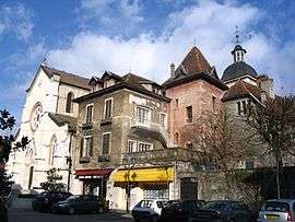 The church square in Saint-Genix-sur-Guiers | ||
| ||
 Saint-Genix-sur-Guiers Location within Auvergne-Rhône-Alpes region  Saint-Genix-sur-Guiers | ||
| Coordinates: 45°36′05″N 5°38′07″E / 45.6014°N 5.6353°ECoordinates: 45°36′05″N 5°38′07″E / 45.6014°N 5.6353°E | ||
| Country | France | |
| Region | Auvergne-Rhône-Alpes | |
| Department | Savoie | |
| Arrondissement | Chambéry | |
| Canton | Bugey savoyard | |
| Intercommunality | Val de Guiers | |
| Government | ||
| • Mayor (2014–2020) | Joël Primard | |
| Area1 | 12.27 km2 (4.74 sq mi) | |
| Population (2014)2 | 2,368 | |
| • Density | 190/km2 (500/sq mi) | |
| Time zone | UTC+1 (CET) | |
| • Summer (DST) | UTC+2 (CEST) | |
| INSEE/Postal code | 73236 /73240 | |
| Elevation | 208–489 m (682–1,604 ft) | |
| Website | www.saint-genix-sur-guiers.com | |
|
1 French Land Register data, which excludes lakes, ponds, glaciers > 1 km2 (0.386 sq mi or 247 acres) and river estuaries. 2 Population without double counting: residents of multiple communes (e.g., students and military personnel) only counted once. | ||
.svg.png)
Saint-Genix-sur-Guiers is a commune in the Savoie department in the Auvergne-Rhône-Alpes region in south-eastern France.
See also
References
External links
| Wikimedia Commons has media related to Saint-Genix-sur-Guiers. |
This article is issued from
Wikipedia.
The text is licensed under Creative Commons - Attribution - Sharealike.
Additional terms may apply for the media files.