Esserts-Blay
| Esserts-Blay | |
|---|---|
| Commune | |
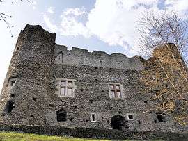 The Manor of Blay | |
 Esserts-Blay Location within Auvergne-Rhône-Alpes region  Esserts-Blay | |
| Coordinates: 45°36′50″N 6°26′11″E / 45.6139°N 6.4364°ECoordinates: 45°36′50″N 6°26′11″E / 45.6139°N 6.4364°E | |
| Country | France |
| Region | Auvergne-Rhône-Alpes |
| Department | Savoie |
| Arrondissement | Albertville |
| Canton | Albertville-1 |
| Intercommunality | Région d'Albertville |
| Government | |
| • Mayor (2014–2020) | Raphaël Thévenon |
| Area1 | 15.51 km2 (5.99 sq mi) |
| Population (2014)2 | 795 |
| • Density | 51/km2 (130/sq mi) |
| • Urban | 43,225 |
| Time zone | UTC+1 (CET) |
| • Summer (DST) | UTC+2 (CEST) |
| INSEE/Postal code | 73110 /73540 |
| Elevation | 345–2,080 m (1,132–6,824 ft) |
| Website | www.essertsblay.com |
|
1 French Land Register data, which excludes lakes, ponds, glaciers > 1 km2 (0.386 sq mi or 247 acres) and river estuaries. 2 Population without double counting: residents of multiple communes (e.g., students and military personnel) only counted once. | |
Esserts-Blay is a commune in the Savoie department in the Auvergne-Rhône-Alpes region in south-eastern France.
See also
References
External links
| Wikimedia Commons has media related to Esserts-Blay. |
This article is issued from
Wikipedia.
The text is licensed under Creative Commons - Attribution - Sharealike.
Additional terms may apply for the media files.