Saint-Colomban-des-Villards
| Saint-Colomban-des-Villards | |
|---|---|
| Commune | |
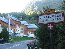 The road into Saint-Colomban-des-Villards | |
 Saint-Colomban-des-Villards Location within Auvergne-Rhône-Alpes region  Saint-Colomban-des-Villards | |
| Coordinates: 45°17′42″N 6°13′38″E / 45.295°N 6.2272°ECoordinates: 45°17′42″N 6°13′38″E / 45.295°N 6.2272°E | |
| Country | France |
| Region | Auvergne-Rhône-Alpes |
| Department | Savoie |
| Arrondissement | Saint-Jean-de-Maurienne |
| Canton | Saint-Jean-de-Maurienne |
| Intercommunality | Vallée du Glandon |
| Government | |
| • Mayor (2014–2020) | Pierre-Yves Bonnivard |
| Area1 | 81.12 km2 (31.32 sq mi) |
| Population (2014)2 | 192 |
| • Density | 2.4/km2 (6.1/sq mi) |
| Time zone | UTC+1 (CET) |
| • Summer (DST) | UTC+2 (CEST) |
| INSEE/Postal code | 73230 /73130 |
| Elevation | 955–2,908 m (3,133–9,541 ft) |
|
1 French Land Register data, which excludes lakes, ponds, glaciers > 1 km2 (0.386 sq mi or 247 acres) and river estuaries. 2 Population without double counting: residents of multiple communes (e.g., students and military personnel) only counted once. | |
Saint-Colomban-des-Villards is a commune in the Savoie department in the Auvergne-Rhône-Alpes region in south-eastern France.
It is a small ski resort, part of the larger Les Sybelles ski area.
See also
References
| Wikimedia Commons has media related to Saint-Colomban-des-Villards. |
This article is issued from
Wikipedia.
The text is licensed under Creative Commons - Attribution - Sharealike.
Additional terms may apply for the media files.