Nilma, Victoria
| Nilma Victoria | |||||||||||||||
|---|---|---|---|---|---|---|---|---|---|---|---|---|---|---|---|
 Nilma | |||||||||||||||
| Coordinates | 38°11′0″S 145°58′0″E / 38.18333°S 145.96667°ECoordinates: 38°11′0″S 145°58′0″E / 38.18333°S 145.96667°E | ||||||||||||||
| Population | 218 (2006 census)[1] | ||||||||||||||
| Postcode(s) | 3821 | ||||||||||||||
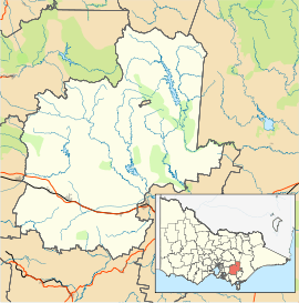
| Location | |||||||||||||||
| LGA(s) | Shire of Baw Baw | ||||||||||||||
| State electorate(s) | Narracan | ||||||||||||||
| Federal Division(s) | McMillan | ||||||||||||||
| |||||||||||||||
Nilma is a small town in the West Gippsland region of Victoria, Australia located between Warragul and Darnum. At the 2006 census Nilma had a population of 218.
The Post Office opened on 1 May 1886 as Bloomfield Railway Station, was renamed Nilma in 1909 and closed in 1979.[2]
The town in conjunction with neighbouring township Darnum has an Australian Rules football team competing in the Ellinbank & District Football League.[3]
References
- ↑ Australian Bureau of Statistics (25 October 2007). "Nilma (State Suburb)". 2006 Census QuickStats. Retrieved 2007-10-01.
- ↑ Premier Postal History, Post Office List, retrieved 2008-04-11
- ↑ Full Points Footy, Nilma Darnum, archived from the original on November 20, 2008, retrieved 2008-07-25
This article is issued from
Wikipedia.
The text is licensed under Creative Commons - Attribution - Sharealike.
Additional terms may apply for the media files.