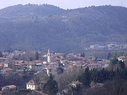
Rodero
| Rodero Rödur (Lombard) | |
|---|---|
| Comune | |
| Comune di Rodero | |
 | |
 Rodero Location of Rodero in Italy | |
| Coordinates: 45°49′N 8°55′E / 45.817°N 8.917°ECoordinates: 45°49′N 8°55′E / 45.817°N 8.917°E | |
| Country | Italy |
| Region | Lombardy |
| Province | Como (CO) |
| Government | |
| • Mayor | Domenico Roncagli |
| Area | |
| • Total | 2.52 km2 (0.97 sq mi) |
| Elevation | 400 m (1,300 ft) |
| Population (31 March 2017)[1] | |
| • Total | 1,321 |
| • Density | 520/km2 (1,400/sq mi) |
| Demonym(s) | Roderesi |
| Time zone | UTC+1 (CET) |
| • Summer (DST) | UTC+2 (CEST) |
| Postal code | 22070 |
| Dialing code | 031 |
| Website | Official website |
Rodero (Comasco: Rödur [ˈrøːdur]) is a comune (municipality) in the Province of Como in the Italian region Lombardy, located about 45 kilometres (28 mi) northwest of Milan and about 13 kilometres (8 mi) west of Como, on the border with Switzerland.
Rodero borders the following municipalities: Bizzarone, Cagno, Cantello, Stabio (Switzerland), Valmorea.
Lanza is the name of the main stream that flows in Rodero.
References
External links

This article is issued from
Wikipedia.
The text is licensed under Creative Commons - Attribution - Sharealike.
Additional terms may apply for the media files.