Cirimido
| Cirimido Scirimed (Lombard) | |
|---|---|
| Comune | |
| Comune di Cirimido | |
 Cirimido Location of Cirimido in Italy | |
| Coordinates: 45°42′N 9°1′E / 45.700°N 9.017°ECoordinates: 45°42′N 9°1′E / 45.700°N 9.017°E | |
| Country | Italy |
| Region | Lombardy |
| Province | Province of Como (CO) |
| Area | |
| • Total | 2.6 km2 (1.0 sq mi) |
| Elevation | 290 m (950 ft) |
| Population (Dec. 2004) | |
| • Total | 2,052 |
| • Density | 790/km2 (2,000/sq mi) |
| Demonym(s) | Cirimidesi |
| Time zone | UTC+1 (CET) |
| • Summer (DST) | UTC+2 (CEST) |
| Postal code | 22070 |
| Dialing code | 031 |
| Website | Official website |
Cirimido (Comasco: Scirimed [ʃiˈriːmet]) is a comune (municipality) in the Province of Como in the Italian region Lombardy, located about 30 kilometres (19 mi) northwest of Milan and about 14 kilometres (9 mi) southwest of Como. As of 31 December 2004, it had a population of 2,052 and an area of 2.6 km².[1]
Cirimido borders the following municipalities: Fenegrò, Guanzate, Lomazzo, Turate.
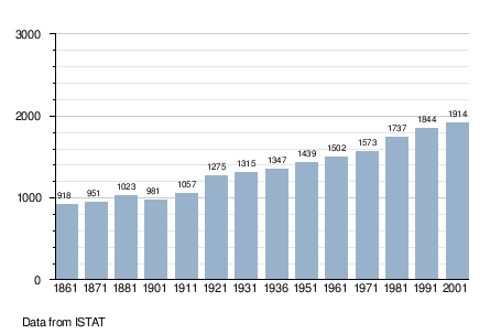
Demographic evolution
References
External links

This article is issued from
Wikipedia.
The text is licensed under Creative Commons - Attribution - Sharealike.
Additional terms may apply for the media files.