Castelmarte
| Castelmarte Castell Mart | |
|---|---|
| Comune | |
| Comune di Castelmarte | |
 Castelmarte Location of Castelmarte in Italy | |
| Coordinates: 45°50′N 9°14′E / 45.833°N 9.233°ECoordinates: 45°50′N 9°14′E / 45.833°N 9.233°E | |
| Country | Italy |
| Region | Lombardy |
| Province | Province of Como (CO) |
| Area | |
| • Total | 1.9 km2 (0.7 sq mi) |
| Elevation | 459 m (1,506 ft) |
| Population (Dec. 2004) | |
| • Total | 1,293 |
| • Density | 680/km2 (1,800/sq mi) |
| Demonym(s) | urcéla (west.lmo. traditional gentilic) |
| Time zone | UTC+1 (CET) |
| • Summer (DST) | UTC+2 (CEST) |
| Postal code | 22030 |
| Dialing code | 031 |
Castelmarte (Brianzöö: Castell Mart [kasˌtɛl ˈmɑːrt]) is a comune (municipality) in the Province of Como in the Italian region Lombardy, located about 40 kilometres (25 mi) north of Milan and about 12 kilometres (7.5 mi) east of Como. As of 31 December 2004, it had a population of 1,293 and an area of 1.9 square kilometres (0.73 sq mi).[1]
Castelmarte borders the following municipalities: Canzo, Caslino d'Erba, Erba, Ponte Lambro, Proserpio.
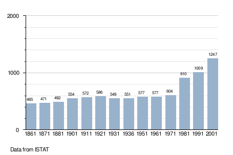
Demographic evolution
References

This article is issued from
Wikipedia.
The text is licensed under Creative Commons - Attribution - Sharealike.
Additional terms may apply for the media files.