Randall, Kansas
| Randall, Kansas | |
|---|---|
| City | |
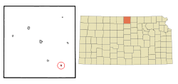 Location within Jewell County and Kansas | |
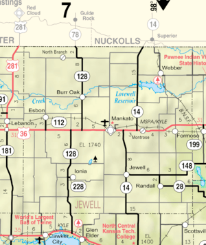 KDOT map of Jewell County (legend) | |
| Coordinates: 39°38′33″N 98°2′39″W / 39.64250°N 98.04417°WCoordinates: 39°38′33″N 98°2′39″W / 39.64250°N 98.04417°W | |
| Country | United States |
| State | Kansas |
| County | Jewell |
| Area[1] | |
| • Total | 0.18 sq mi (0.47 km2) |
| • Land | 0.18 sq mi (0.47 km2) |
| • Water | 0 sq mi (0 km2) |
| Elevation | 1,457 ft (444 m) |
| Population (2010)[2] | |
| • Total | 65 |
| • Estimate (2016)[3] | 62 |
| • Density | 360/sq mi (140/km2) |
| Time zone | UTC-6 (CST) |
| • Summer (DST) | UTC-5 (CDT) |
| ZIP code | 66963 |
| Area code | 785 |
| FIPS code | 20-58450 [4] |
| GNIS ID | 0472113 [5] |
Randall is a city in Jewell County, Kansas, United States. As of the 2010 census, the city population was 65.[6]
History
Randall was originally called Vicksburg, and under the latter name laid out in 1870. It was renamed Randall in 1882.[7] The community was named for Edward Randall, an original owner of the site.[8]
Geography
Randall is located at 39°38′33″N 98°2′39″W / 39.64250°N 98.04417°W (39.642566, -98.044250).[9] According to the United States Census Bureau, the city has a total area of 0.18 square miles (0.47 km2), all of it land.[1]
Demographics
| Historical population | |||
|---|---|---|---|
| Census | Pop. | %± | |
| 1890 | 239 | — | |
| 1900 | 268 | 12.1% | |
| 1910 | 325 | 21.3% | |
| 1920 | 304 | −6.5% | |
| 1930 | 262 | −13.8% | |
| 1940 | 281 | 7.3% | |
| 1950 | 240 | −14.6% | |
| 1960 | 201 | −16.2% | |
| 1970 | 195 | −3.0% | |
| 1980 | 154 | −21.0% | |
| 1990 | 96 | −37.7% | |
| 2000 | 90 | −6.2% | |
| 2010 | 65 | −27.8% | |
| Est. 2016 | 62 | [3] | −4.6% |
| U.S. Decennial Census | |||
2010 census
As of the census[2] of 2010, there were 65 people, 34 households, and 20 families residing in the city. The population density was 361.1 inhabitants per square mile (139.4/km2). There were 65 housing units at an average density of 361.1 per square mile (139.4/km2). The racial makeup of the city was 96.9% White, 1.5% African American, and 1.5% from two or more races. Hispanic or Latino of any race were 3.1% of the population.
There were 34 households of which 20.6% had children under the age of 18 living with them, 55.9% were married couples living together, 2.9% had a female householder with no husband present, and 41.2% were non-families. 41.2% of all households were made up of individuals and 32.3% had someone living alone who was 65 years of age or older. The average household size was 1.91 and the average family size was 2.55.
The median age in the city was 57.8 years. 16.9% of residents were under the age of 18; 1.5% were between the ages of 18 and 24; 16.9% were from 25 to 44; 30.8% were from 45 to 64; and 33.8% were 65 years of age or older. The gender makeup of the city was 43.1% male and 56.9% female.
2000 census
As of the census[4] of 2000, there were 90 people, 45 households, and 27 families residing in the city. The population density was 495.6 people per square mile (193.1/km²). There were 72 housing units at an average density of 396.5 per square mile (154.4/km²). The racial makeup of the city was 100.00% White. Hispanic or Latino of any race were 1.11% of the population.
There were 45 households out of which 22.2% had children under the age of 18 living with them, 53.3% were married couples living together, 6.7% had a female householder with no husband present, and 40.0% were non-families. 40.0% of all households were made up of individuals and 26.7% had someone living alone who was 65 years of age or older. The average household size was 2.00 and the average family size was 2.67.
In the city, the population was spread out with 21.1% under the age of 18, 3.3% from 18 to 24, 17.8% from 25 to 44, 20.0% from 45 to 64, and 37.8% who were 65 years of age or older. The median age was 51 years. For every 100 females, there were 83.7 males. For every 100 females age 18 and over, there were 82.1 males.
The median income for a household in the city was $26,250, and the median income for a family was $29,000. Males had a median income of $22,500 versus $26,250 for females. The per capita income for the city was $11,313. There were 3.3% of families and 4.1% of the population living below the poverty line, including 12.5% of under eighteens and none of those over 64.
Education
School unification consolidated Randall into Rock Hills USD 107 in 2006. Rock Hills Jr/Sr High School's mascot is the Grizzlies.[10]
Randall and Jewell schools were consolidated into Jewell-Randall schools in the 1960s. Prior to unification, the Randall High School mascot was Randall Panthers.[11]
References
- 1 2 "US Gazetteer files 2010". United States Census Bureau. Archived from the original on 2012-07-14. Retrieved 2012-07-06.
- 1 2 "American FactFinder". United States Census Bureau. Retrieved 2012-07-06.
- 1 2 "Population and Housing Unit Estimates". Retrieved June 9, 2017.
- 1 2 "American FactFinder". United States Census Bureau. Retrieved 2008-01-31.
- ↑ "US Board on Geographic Names". United States Geological Survey. 2007-10-25. Retrieved 2008-01-31.
- ↑ "2010 City Population and Housing Occupancy Status". U.S. Census Bureau. Retrieved October 10, 2011.
- ↑ Kansas State Historical Society (1916). Biennial Report of the Board of Directors of the Kansas State Historical Society. Kansas State Printing Plant. p. 212.
- ↑ "Profile for Randall, Kansas". ePodunk. Retrieved 12 June 2014.
- ↑ "US Gazetteer files: 2010, 2000, and 1990". United States Census Bureau. 2011-02-12. Retrieved 2011-04-23.
- ↑ "Rock Hills". USD 107. Retrieved 1 January 2017.
- ↑ "TWO SCANDIA VICTORIES", The Belleville Telescope, 15 January 1948, p.1.
External links
| Wikimedia Commons has media related to Randall, Kansas. |
- City
- Schools
- USD 107, local school district
- Maps
- Randall City Map, KDOT
Municipalities and communities of Jewell County, Kansas, United States | ||
|---|---|---|
| Cities | 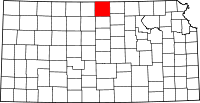 | |
| Unincorporated communities | ||
| Townships | ||