Dentonia, Kansas
| Dentonia, Kansas | |
|---|---|
| Unincorporated community | |
 Dentonia  Dentonia | |
| Coordinates: 39°41′02″N 98°28′03″W / 39.68389°N 98.46750°WCoordinates: 39°41′02″N 98°28′03″W / 39.68389°N 98.46750°W | |
| Country | United States |
| State | Kansas |
| County | Jewell |
| Elevation | 1,736 ft (529 m) |
| Time zone | UTC-6 (Central (CST)) |
| • Summer (DST) | UTC-5 (CDT) |
| Area code(s) | 785 |
| GNIS feature ID | 484589[1] |
Dentonia is an unincorporated community in Jewell County, Kansas, United States.[1]
Notes
Municipalities and communities of Jewell County, Kansas, United States | ||
|---|---|---|
| Cities | 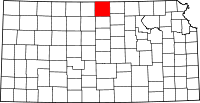 | |
| Unincorporated communities | ||
| Townships | ||
This article is issued from
Wikipedia.
The text is licensed under Creative Commons - Attribution - Sharealike.
Additional terms may apply for the media files.