Pipariya, Janakpur
| Pipariya पिपरिया | |
|---|---|
| Village development committee | |
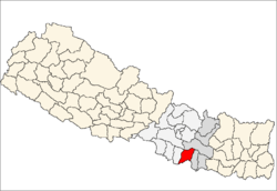
 Pipariya Location in Nepal | |
| Coordinates: 26°58′44″N 85°31′50″E / 26.97889°N 85.53056°ECoordinates: 26°58′44″N 85°31′50″E / 26.97889°N 85.53056°E | |
| Country |
|
| Zone | Janakpur Zone |
| District | Sarlahi District |
| Population (2011) | |
| • Total | 6,991 |
| • Density | 389/km2 (1,010/sq mi) |
| Census[1] | |
| Languages | |
| • Official | Maithili, Nepali |
| Time zone | UTC+5:45 (Nepal Time) |
| Area code(s) | 046 |
| Vehicle registration | JA-1-P |
Pipariya is a village development committee in Sarlahi District in the Janakpur Zone of south-eastern Nepal. At present it's part of Kabilasi Municipality. It includes 2 Wards of Kabilasi i.e 1&2. According to the CBS 2011 it is carrying 1218 households and total population 6991 including 3581 Males and 3410 Females.[2]
Demographics
At the time of the 2011 Nepal census it had a population of 6,911 people residing in 1218 individual households including 3581 Males and 3410 Females.[3]
Geographical
It is located in the Terai Region of Sarlahi District and Janakpur Zone. It is a VDC of Sarlahi District. It is situated 12 km south from Mahendra Highway, Nawalpur. It has fertile land for cultivation, chief crops grown here are Sugarcane, Paddy, Wheat, Pulses and etc. It has good irrigation facilities but can be made even better. Lakhandei River surrounds it from west and a stream called Dhangra From east. There is Jungle just beside Lakhandei River. The Jungle is now Community Forest. There are 6 parliamentary constituency in Sarlahi District. Pipariya falls under area 2.
Border
- North – Pidari VDC 1 km
- South – Rahaniya, Sarlahi 2 km
- East - Gair-9, Kabilasi VDC 4 km
- East – Haraiya, Farahadawa VDC, 3 km
- West – Gangapur & Tikuliya Separated by Lakhandei River.
Education
There are Government and Private institutions in order to provide quality education.
- Shree Bal Govind Janta Uchha Madhyamik Bidyalaya.
It was established in 2017 B.S.
- Sunrise English Boarding School
- K.D.S
- Madarsha
HealthCare
- Pipariya Sub-health Post
References
- ↑ Government of Nepal, Central Bureau of Statistics (2011). "Nepal population and housing census 2011" (PDF).
- ↑ "Nepal Census 2001". Digital Himalaya. Archived from the original on October 12, 2008. Retrieved 2 November 2008.
- ↑ General Bureau of Statistics, Kathmandu, Nepal, Nov. 2012
Volume 02,NPHC 2011, Nepal Population And Housing Census[NPHC]2011(Village Development Committee/Municipality)
External links